Livry-Gargan
You can help expand this article with text translated from the corresponding article in French. (December 2009) Click [show] for important translation instructions.
|
Livry-Gargan | |
|---|---|
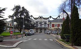
 Livry-Gargan town hall | |
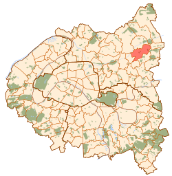
 Paris and inner ring departments | |
| Coordinates: 48°55′09″N 2°32′10″E / 48.9192°N 2.5361°E | |
| Country | France |
| Region | Île-de-France |
| Department | Seine-Saint-Denis |
| Arrondissement | Le Raincy |
| Canton | Livry-Gargan |
| Intercommunality | Grand Paris |
| Government | |
| • Mayor (2020–2026) | Pierre-Yves Martin[1] |
Area 1 | 7.38 km2 (2.85 sq mi) |
| Population (2021)[2] | 46,028 |
| • Density | 6,200/km2 (16,000/sq mi) |
| Time zone | UTC+01:00 (CET) |
| • Summer (DST) | UTC+02:00 (CEST) |
| INSEE/Postal code | 93046 /93190 |
| Elevation | 54–125 m (177–410 ft) |
| 1 French Land Register data, which excludes lakes, ponds, glaciers > 1 km2 (0.386 sq mi or 247 acres) and river estuaries. | |
Livry-Gargan (French pronunciation: [livʁi ɡaʁgɑ̃] ) is a commune in the northeastern suburbs of Paris, France. It is located 15.6 km (9.7 mi) from the center of Paris.
History
[edit]This section needs expansion. You can help by adding to it. (May 2024) |
During the Middle Ages, the lordship of Livry (seigneur de Livry) was held by members of the House of Garlande before passing to Pierre de Chambly, chamberlain of King Philip IV, in 1285.
On 20 May, 1869, a part of the territory of Livry-Gargan was detached and merged with a part of the territory of Clichy-sous-Bois and a small part of the territory of Gagny to create the commune of Le Raincy.
Population
[edit]
|
| ||||||||||||||||||||||||||||||||||||||||||||||||||||||||||||||||||||||||||||||||||||||||||||||||||||||||||||||||||
| |||||||||||||||||||||||||||||||||||||||||||||||||||||||||||||||||||||||||||||||||||||||||||||||||||||||||||||||||||
| Source: EHESS[3] and INSEE (1968-2017)[4] | |||||||||||||||||||||||||||||||||||||||||||||||||||||||||||||||||||||||||||||||||||||||||||||||||||||||||||||||||||
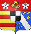
Heraldry
[edit]Transport
[edit]Livry-Gargan is not served by any station of the Paris Métro, RER, or suburban rail network. The closest station to Livry-Gargan is Sevran – Livry station on Paris RER line B. This station is located in the neighboring commune of Sevran, 1.9 km (1.2 mi) from the town center of Livry-Gargan. Tram 4 Gargan Station is very near to the village and in tram 4 direction Hopital de Montfermeil there are two more station "République Marx-Dormoy" and "Léon Blum". These two stations are inside the village Livry-Gargan.
Education
[edit]Schools include:[5]
- 9 preschools
- 9 elementary schools
- Junior high schools: LÉON-JOUHAUX, SEGPA du collège, ÉDOUARD-HERRIOT, LUCIE-AUBRAC
- Senior high schools: Lycée André Boulloche, Lycée Henri Sellier
Twin towns
[edit]Livry-Gargan is twinned with the communities of:
Personalities
[edit]- Grégory Arnolin, born in 1980, footballer
- Cassandre Beaugrand, born in 1997, Triathlete and Olympic Gold Medalist
- Karim Cheurfi, perpetrator of the 2017 shooting of Paris police officers
- Laetitia Avia, born in 1985, politician
- Aïssa Laïdouni, born in 1996, footballer
- Ryad Hachem, born in 1998, footballer
See also
[edit]References
[edit]- ^ "Répertoire national des élus: les maires". data.gouv.fr, Plateforme ouverte des données publiques françaises (in French). 2 December 2020.
- ^ "Populations légales 2021" (in French). The National Institute of Statistics and Economic Studies. 28 December 2023.
- ^ Des villages de Cassini aux communes d'aujourd'hui: Commune data sheet Livry-Gargan, EHESS (in French).
- ^ Population en historique depuis 1968, INSEE
- ^ "Enseignement." Livry-Gargan. Retrieved on September 7, 2016.
External links
[edit]- Official website (in French)


