[ 3] Name on the Register
Image
Date listed[ 4]
Location
Neighborhood
Description
1
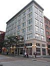
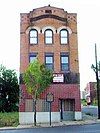
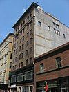
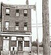
109–115 Wood Street 109–115 Wood Street April 4, 1996 (#96000378 ) 109–115 Wood Street 40°26′18″N 80°00′09″W / 40.438333°N 80.0025°W / 40.438333; -80.0025 (109–115 Wood Street ) Central Business District
2
Allegheny Cemetery Allegheny Cemetery December 10, 1980 (#80003405 ) Roughly bounded by North Mathilda and Butler Streets, and Penn, Stanton, and Mossfield Avenues 40°28′21″N 79°56′52″W / 40.4725°N 79.947778°W / 40.4725; -79.947778 (Allegheny Cemetery ) Central Lawrenceville
3
Allegheny Commons Allegheny Commons September 17, 2013 (#13000740 ) Roughly bounded by Stockton Street, Brighton Road, North, Cedar and Ridge Avenues 40°27′12″N 80°00′44″W / 40.453444°N 80.012194°W / 40.453444; -80.012194 (Allegheny Commons ) Allegheny Center
4
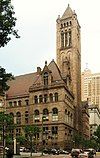
Allegheny County Courthouse and Jail Allegheny County Courthouse and Jail March 7, 1973 (#73001586 ) 436 Grant Street 40°26′19″N 79°59′46″W / 40.438611°N 79.996111°W / 40.438611; -79.996111 (Allegheny County Courthouse and Jail ) Central Business District
5
Allegheny High School Allegheny High School September 30, 1986 (#86002643 ) 810 Arch Street 40°27′11″N 80°00′32″W / 40.453056°N 80.008889°W / 40.453056; -80.008889 (Allegheny High School ) Allegheny Center
6
Allegheny Observatory Allegheny Observatory June 22, 1979 (#79002157 ) 159 Riverview Avenue 40°28′53″N 80°01′11″W / 40.481389°N 80.019722°W / 40.481389; -80.019722 (Allegheny Observatory ) Perry North
7
Allegheny Post Office Allegheny Post Office July 27, 1971 (#71000683 ) Allegheny Center 40°27′09″N 80°00′26″W / 40.4525°N 80.007222°W / 40.4525; -80.007222 (Allegheny Post Office ) Allegheny Center
8
Allegheny River Lock and Dam No. 2 Allegheny River Lock and Dam No. 2 April 21, 2000 (#00000396 ) 7451 Lockway West 40°29′24″N 79°54′51″W / 40.49°N 79.914167°W / 40.49; -79.914167 (Allegheny River Lock and Dam No. 2 ) Highland Park Extends into O'Hara Township , elsewhere in Allegheny County
9
Allegheny West Historic District Allegheny West Historic District November 2, 1978 (#78002334 ) Roughly bounded by Brighton Road, Jabok Way, Ridge and Allegheny Avenues 40°27′07″N 80°00′01″W / 40.451944°N 80.000278°W / 40.451944; -80.000278 (Allegheny West Historic District ) Allegheny West
10
Taylor Allderdice High School Taylor Allderdice High School September 30, 1986 (#86002641 ) 2409 Shady Avenue 40°25′46″N 79°55′11″W / 40.429444°N 79.919722°W / 40.429444; -79.919722 (Taylor Allderdice High School ) Squirrel Hill South
11
Alpha Terrace Historic District Alpha Terrace Historic District July 18, 1985 (#85001570 ) 716–740 and 721–743 North Beatty Street 40°28′10″N 79°55′22″W / 40.469367°N 79.922653°W / 40.469367; -79.922653 (Alpha Terrace Historic District ) East Liberty
12
Armstrong Cork Company Armstrong Cork Company May 10, 2005 (#05000413 ) 23rd and Railroad Streets 40°27′16″N 79°59′00″W / 40.454467°N 79.983278°W / 40.454467; -79.983278 (Armstrong Cork Company ) Strip District
13
Armstrong Tunnel Armstrong Tunnel January 7, 1986 (#86000015 ) Between Forbes and 2nd Avenues at S. 10th Street 40°26′16″N 79°59′33″W / 40.437778°N 79.9925°W / 40.437778; -79.9925 (Armstrong Tunnel ) Bluff
14
Arsenal Junior High School Arsenal Junior High School September 30, 1986 (#86002645 ) Butler and 40th Streets 40°28′03″N 79°57′46″W / 40.4675°N 79.962778°W / 40.4675; -79.962778 (Arsenal Junior High School ) Lower Lawrenceville
15
Baxter High School Baxter High School September 30, 1986 (#86002647 ) Baxter Street and Brushton Avenue 40°27′23″N 79°53′17″W / 40.456311°N 79.888111°W / 40.456311; -79.888111 (Baxter High School ) Homewood North
16
Bayard School Bayard School September 30, 1986 (#86002649 ) 4830 Hatfield Street 40°28′37″N 79°57′29″W / 40.476944°N 79.958056°W / 40.476944; -79.958056 (Bayard School ) Central Lawrenceville
17
Bedford School Bedford School September 30, 1986 (#86002651 ) 910–918 Bingham Street 40°25′45″N 79°59′22″W / 40.429167°N 79.989444°W / 40.429167; -79.989444 (Bedford School ) South Side Flats
18
Beechwood Elementary School Beechwood Elementary School September 30, 1986 (#86002656 ) Rockland Avenue near Sebring Avenue 40°24′52″N 80°01′14″W / 40.414533°N 80.020617°W / 40.414533; -80.020617 (Beechwood Elementary School ) Beechview
19
Bell Telephone Company of Pennsylvania Western Headquarters Building Bell Telephone Company of Pennsylvania Western Headquarters Building December 15, 2011 (#11000921 ) 201 Stanwix Street 40°26′25″N 80°00′18″W / 40.440172°N 80.005097°W / 40.440172; -80.005097 (Bell Telephone Company of Pennsylvania Western Headquarters Building ) Central Business District
20
Beltzhoover Elementary School Beltzhoover Elementary School September 30, 1986 (#86002657 ) Cedarhurst and Estrella Streets 40°25′05″N 80°00′06″W / 40.418075°N 80.00175°W / 40.418075; -80.00175 (Beltzhoover Elementary School ) Beltzhoover
21
Bindley Hardware Company Building Bindley Hardware Company Building August 8, 1985 (#85001748 ) 401 Amberson Avenue 40°27′13″N 79°56′28″W / 40.453611°N 79.941111°W / 40.453611; -79.941111 (Bindley Hardware Company Building ) Shadyside
22
Birmingham Public School Birmingham Public School September 30, 1986 (#86002658 ) 118–128 S. 15th Street 40°25′38″N 79°59′01″W / 40.427272°N 79.983667°W / 40.427272; -79.983667 (Birmingham Public School ) South Side Flats
23
Boggs Avenue Elementary School Boggs Avenue Elementary School February 3, 1987 (#86002659 ) Boggs and Southern Avenues 40°25′02″N 80°00′48″W / 40.4172°N 80.013453°W / 40.4172; -80.013453 (Boggs Avenue Elementary School ) Mount Washington
24
Boys' Club of Pittsburgh Boys' Club of Pittsburgh January 19, 2018 (#100001976 ) 212 45th St. 40°28′19″N 79°57′33″W / 40.471990°N 79.959040°W / 40.471990; -79.959040 (Boys' Club of Pittsburgh ) Central Lawrenceville
25
John A. Brashear House and Factory John A. Brashear House and Factory December 6, 2012 (#12001093 ) 1954 Perrysville Ave. 40°27′47″N 80°00′48″W / 40.463056°N 80.013333°W / 40.463056; -80.013333 (John A. Brashear House and Factory ) Perry South Factory demolished after wall collapse, March 18, 2015
26
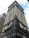
Buhl Building Buhl Building January 3, 1980 (#80003406 ) 204 5th Avenue 40°26′28″N 80°00′07″W / 40.441111°N 80.001944°W / 40.441111; -80.001944 (Buhl Building ) Central Business District
27
Burke Building Burke Building September 18, 1978 (#78002335 ) 2097–211 4th Avenue 40°26′24″N 80°00′09″W / 40.44°N 80.0025°W / 40.44; -80.0025 (Burke Building ) Central Business District
28
Butler Street Gatehouse Butler Street Gatehouse July 30, 1974 (#74001734 ) 4734 Butler Street 40°28′30″N 79°57′27″W / 40.475°N 79.9575°W / 40.475; -79.9575 (Butler Street Gatehouse ) Central Lawrenceville
29
Byers-Lyons House Byers-Lyons House November 19, 1974 (#74001735 ) 901 Ridge Avenue 40°26′59″N 80°00′58″W / 40.449722°N 80.016111°W / 40.449722; -80.016111 (Byers-Lyons House ) Allegheny West
30
Byrnes & Kiefer Building Byrnes & Kiefer Building March 7, 1985 (#85000457 ) 1127–1133 Penn Avenue 40°26′44″N 79°59′36″W / 40.445556°N 79.993333°W / 40.445556; -79.993333 (Byrnes & Kiefer Building ) Strip District
31
Calvary Episcopal Church Calvary Episcopal Church April 18, 2012 (#12000219 ) 315 Shady Ave. 40°27′22″N 79°55′20″W / 40.456111°N 79.922222°W / 40.456111; -79.922222 (Calvary Episcopal Church ) Shadyside
32
Carnegie Free Library of Allegheny Carnegie Free Library of Allegheny November 1, 1974 (#74001736 ) Allegheny Center 40°27′11″N 80°00′19″W / 40.453056°N 80.005278°W / 40.453056; -80.005278 (Carnegie Free Library of Allegheny ) Allegheny Center
33
Carnegie Institute and Library Carnegie Institute and Library March 30, 1979 (#79002158 ) 4400 Forbes Avenue 40°26′34″N 79°57′02″W / 40.442778°N 79.950556°W / 40.442778; -79.950556 (Carnegie Institute and Library ) North Oakland
34
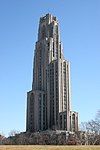
Cathedral of Learning Cathedral of Learning November 3, 1975 (#75001608 ) Forbes Avenue and Bigelow Boulevard 40°26′40″N 79°57′09″W / 40.444444°N 79.9525°W / 40.444444; -79.9525 (Cathedral of Learning ) North Oakland
35
Centre Avenue YMCA Centre Avenue YMCA November 3, 2021 (#100007092 ) 2621 Centre Ave. 40°26′50″N 79°58′04″W / 40.4472°N 79.9677°W / 40.4472; -79.9677 (Centre Avenue YMCA ) Middle Hill
36
Century Building Century Building August 13, 2008 (#08000781 ) 130 7th Street 40°26′37″N 80°00′02″W / 40.443669°N 80.000667°W / 40.443669; -80.000667 (Century Building ) Central Business District
37
Chatham Village Historic District Chatham Village Historic District November 25, 1998 (#98001372 ) Roughly bounded by Virginia Avenue, Bigham Street, Woodruff Street, Saw Mill Run Boulevard, and Olympia Road 40°25′52″N 80°01′01″W / 40.431111°N 80.016944°W / 40.431111; -80.016944 (Chatham Village Historic District ) Mount Washington
38
Colfax Elementary School Colfax Elementary School September 30, 1986 (#86002660 ) Beechwood Boulevard and Phillips Avenue 40°25′59″N 79°54′55″W / 40.433103°N 79.915403°W / 40.433103; -79.915403 (Colfax Elementary School ) Squirrel Hill South
39
Clifford B. Connelly Trade School Clifford B. Connelly Trade School September 30, 1986 (#86002661 ) 1501 Bedford Avenue 40°26′39″N 79°59′19″W / 40.444244°N 79.988667°W / 40.444244; -79.988667 (Clifford B. Connelly Trade School ) Crawford-Roberts
40
Conroy Junior High School Conroy Junior High School September 30, 1986 (#86002662 ) Page and Fulton Streets 40°27′06″N 80°01′27″W / 40.451767°N 80.024167°W / 40.451767; -80.024167 (Conroy Junior High School ) Manchester
41
Consolidated Ice Company Factory No. 2 Consolidated Ice Company Factory No. 2 November 8, 2000 (#00001348 ) 100 43rd Street 40°28′28″N 79°57′51″W / 40.474444°N 79.964167°W / 40.474444; -79.964167 (Consolidated Ice Company Factory No. 2 ) Central Lawrenceville
42
Crawford Grill No. 2 Crawford Grill No. 2 July 23, 2020 (#100005373 ) 2141 Wylie Ave. 40°26′43″N 79°58′40″W / 40.4454°N 79.9779°W / 40.4454; -79.9779 (Crawford Grill No. 2 ) Middle Hill
43
Deutschtown Historic District Deutschtown Historic District November 25, 1983 (#83004181 ) Roughly bounded by Cedar Avenue, Knoll, East, and Pressley Streets 40°27′18″N 80°00′00″W / 40.455°N 80.0°W / 40.455; -80.0 (Deutschtown Historic District ) East Allegheny
44
Dilworth Elementary School Dilworth Elementary School September 30, 1986 (#86002663 ) Saint Marie and Collins Streets 40°28′06″N 79°55′03″W / 40.4682°N 79.9175°W / 40.4682; -79.9175 (Dilworth Elementary School ) East Liberty
45
Dollar Savings Bank Dollar Savings Bank July 14, 1976 (#76001594 ) 4th Avenue and Smithfield Street 40°26′19″N 80°00′01″W / 40.4386°N 80.0003°W / 40.4386; -80.0003 (Dollar Savings Bank ) Central Business District
46
Duquesne Brewing Company Duquesne Brewing Company May 11, 2015 (#15000217 ) Roughly bounded by S. 21st, S. 23rd & Jane Sts., Harcum & Edwards Ways 40°25′34″N 79°58′29″W / 40.4261°N 79.9748°W / 40.4261; -79.9748 (Duquesne Brewing Company ) South Side Flats
47
Duquesne Incline Duquesne Incline March 4, 1975 (#75001609 ) 1220 Grandview Avenue 40°26′21″N 80°01′05″W / 40.4392°N 80.0181°W / 40.4392; -80.0181 (Duquesne Incline ) Duquesne Heights
48
East Carson Street Historic District East Carson Street Historic District November 17, 1983 (#83004183 ) Roughly East Carson Street from 9th to 24th Street 40°25′43″N 79°58′58″W / 40.4286°N 79.9828°W / 40.4286; -79.9828 (East Carson Street Historic District ) South Side Flats
49
East Liberty Commercial Historic District East Liberty Commercial Historic District December 27, 2010 (#10001072 ) Roughly bounded by Penn, Sheridan, and Centre Avenues and Kirkwood and South Whitfield Streets 40°27′42″N 79°55′30″W / 40.4618°N 79.925°W / 40.4618; -79.925 (East Liberty Commercial Historic District ) East Liberty
50
East Liberty Market East Liberty Market December 12, 1977 (#77001121 ) Centre Avenue and Baum Boulevard 40°27′35″N 79°55′38″W / 40.4598°N 79.9273°W / 40.4598; -79.9273 (East Liberty Market ) East Liberty
51
Eberhardt and Ober Brewery Eberhardt and Ober Brewery November 5, 1987 (#87001984 ) Troy Hill Road and Vinial Street 40°27′25″N 79°59′29″W / 40.4569°N 79.9913°W / 40.4569; -79.9913 (Eberhardt and Ober Brewery ) Troy Hill
52
Emmanuel Episcopal Church Emmanuel Episcopal Church May 3, 1974 (#74001737 ) North and Allegheny Avenues 40°27′11″N 80°01′10″W / 40.4531°N 80.0194°W / 40.4531; -80.0194 (Emmanuel Episcopal Church ) Allegheny West
53
Ewart Building Ewart Building August 9, 1979 (#79002159 ) 921, 923 and 925 Liberty Avenue 40°26′36″N 79°59′52″W / 40.4433°N 79.9978°W / 40.4433; -79.9978 (Ewart Building ) Central Business District
54
Fairfax Apartments Fairfax Apartments December 29, 2021 (#100007257 ) 4614 5th Ave. 40°26′49″N 79°56′54″W / 40.4470°N 79.9482°W / 40.4470; -79.9482 (Fairfax Apartments ) North Oakland
55
Fifth Avenue High School Fifth Avenue High School October 23, 1986 (#86002956 ) 1800 5th Avenue 40°26′17″N 79°58′51″W / 40.4381°N 79.9808°W / 40.4381; -79.9808 (Fifth Avenue High School ) Bluff
56
Firstside Historic District Firstside Historic District July 28, 1988 (#88001215 ) Roughly bounded by the Boulevard of the Allies , Fort Pitt Boulevard , Grant and Stanwix Streets 40°26′17″N 80°00′11″W / 40.4381°N 80.0031°W / 40.4381; -80.0031 (Firstside Historic District ) Central Business District
57
Ford Motor Company Assembly Plant Ford Motor Company Assembly Plant November 20, 2018 (#100003134 ) 5000 Baum Boulevard 40°27′18″N 79°56′42″W / 40.4550°N 79.9450°W / 40.4550; -79.9450 (Ford Motor Company Assembly Plant ) Bloomfield
58
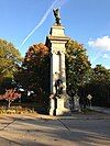
Forks of the Ohio Forks of the Ohio October 15, 1966 (#66000643 ) Point Park 40°26′27″N 80°00′37″W / 40.4408°N 80.0103°W / 40.4408; -80.0103 (Forks of the Ohio ) Central Business District
59
Fort Pitt Elementary School Fort Pitt Elementary School September 30, 1986 (#86002666 ) 5101 Hillcrest Street 40°28′08″N 79°56′30″W / 40.4689°N 79.9418°W / 40.4689; -79.9418 (Fort Pitt Elementary School ) Garfield
60
Fortieth Street Bridge Fortieth Street Bridge June 22, 1988 (#88000820 ) 40th Street over the Allegheny River 40°28′25″N 79°58′12″W / 40.4736°N 79.97°W / 40.4736; -79.97 (Fortieth Street Bridge ) Central Lawrenceville/Lower Lawrenceville Extends into Millvale , elsewhere in Allegheny County
61
Foster School Foster School September 30, 1986 (#86002667 ) 286 Main Street 40°28′03″N 79°57′32″W / 40.4675°N 79.9589°W / 40.4675; -79.9589 (Foster School ) Central Lawrenceville
62
Fourth Avenue Historic District Fourth Avenue Historic District September 5, 1985 (#85001961 ) Roughly bounded by Smithfield Street, Market Square Place, 3rd and 5th Avenues 40°26′22″N 80°00′02″W / 40.4394°N 80.0006°W / 40.4394; -80.0006 (Fourth Avenue Historic District ) Central Business District
63
John Frew House John Frew House May 30, 2001 (#01000593 ) 105 Sterrett Street 40°25′45″N 80°03′31″W / 40.4293°N 80.0586°W / 40.4293; -80.0586 (John Frew House ) Westwood
64
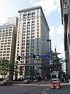
Frick Building and Annex Frick Building and Annex May 22, 1978 (#78002336 ) 437 Grant Street 40°26′20″N 79°59′53″W / 40.4389°N 79.9981°W / 40.4389; -79.9981 (Frick Building and Annex ) Central Business District
65
Frick Park Frick Park February 28, 2019 (#100003450 ) 1981 Beechwood Blvd. 40°26′13″N 79°54′30″W / 40.4369°N 79.9084°W / 40.4369; -79.9084 (Frick Park ) Point Breeze , Regent Square , Squirrel Hill South , Swisshelm Park
66
Henry Clay Frick Training School for Teachers Henry Clay Frick Training School for Teachers September 30, 1986 (#86002668 ) 107 Thackeray Street 40°26′36″N 79°57′29″W / 40.4433°N 79.9581°W / 40.4433; -79.9581 (Henry Clay Frick Training School for Teachers ) North Oakland
67
Fulton Building Fulton Building May 10, 2002 (#02000556 ) 107 6th Street 40°26′38″N 80°00′09″W / 40.4439°N 80.0025°W / 40.4439; -80.0025 (Fulton Building ) Central Business District Now the Byham Theater
68
Fulton Elementary School Fulton Elementary School September 30, 1986 (#86002669 ) Hampton and North Saint Clair Streets 40°28′30″N 79°55′19″W / 40.4749°N 79.9219°W / 40.4749; -79.9219 (Fulton Elementary School ) Highland Park
69
Gladstone School Gladstone School September 17, 2021 (#100006988 ) 327 Hazelwood Ave. 40°24′44″N 79°56′27″W / 40.4123°N 79.9407°W / 40.4123; -79.9407 (Gladstone School ) Hazelwood
70
Greenfield Elementary School Greenfield Elementary School September 30, 1986 (#86002671 ) North of Greenfield Avenue at East end of Alger Street 40°25′35″N 79°56′41″W / 40.4264°N 79.9447°W / 40.4264; -79.9447 (Greenfield Elementary School ) Greenfield
71
Hartley-Rose Belting Company Building Hartley-Rose Belting Company Building August 25, 1983 (#83002212 ) 425–427 1st Avenue 40°26′13″N 79°59′59″W / 40.4369°N 79.9997°W / 40.4369; -79.9997 (Hartley-Rose Belting Company Building ) Central Business District
72
Hazelwood Brewing Company Hazelwood Brewing Company December 21, 2020 (#100005931 ) 5007, 5009, and 5011 Lytle St. 40°24′27″N 79°56′44″W / 40.4075°N 79.9456°W / 40.4075; -79.9456 (Hazelwood Brewing Company ) Hazelwood
73
Heathside Cottage Heathside Cottage December 30, 1974 (#74001740 ) 416 Catoma Street 40°27′39″N 80°00′13″W / 40.4608°N 80.0036°W / 40.4608; -80.0036 (Heathside Cottage ) Fineview
74
H.J. Heinz Company H.J. Heinz Company July 10, 2002 (#02000774 ) Roughly bounded by Chestnut Street, River Avenue, South Canal Street, Progress Street and Heinz modern Manufacturing Facilities 40°27′20″N 79°59′27″W / 40.4555°N 79.9908°W / 40.4555; -79.9908 (H.J. Heinz Company ) Troy Hill
75
Henderson-Metz House Henderson-Metz House August 22, 1979 (#79003141 ) 1516 Warren Street 40°27′37″N 80°00′08″W / 40.4603°N 80.0022°W / 40.4603; -80.0022 (Henderson-Metz House ) Fineview
76
Highland Building Highland Building September 6, 1991 (#91001123 ) 121 South Highland Avenue 40°27′36″N 79°55′29″W / 40.46°N 79.9247°W / 40.46; -79.9247 (Highland Building ) East Liberty
77
Highland Park Highland Park November 25, 2019 (#100004665 ) Roughly bounded by Butler St., Washington Blvd., Stanton Ave., Farmhouse Dr., Bunker Hill St. & Heth's Run 40°28′45″N 79°54′56″W / 40.4793°N 79.9155°W / 40.4793; -79.9155 (Highland Park ) Highland Park
78
Highland Park Residential Historic District Highland Park Residential Historic District August 30, 2007 (#07000888 ) Roughly bounded by Highland Park, Heth's Run and Heth's Avenue, Chislett Street, Stanton Avenue and Jackson Street 40°28′33″N 79°55′48″W / 40.4758°N 79.9299°W / 40.4758; -79.9299 (Highland Park Residential Historic District ) Highland Park
79
Highland Towers Apartments Highland Towers Apartments September 28, 1976 (#76001595 ) 340 South Highland Avenue 40°27′21″N 79°55′32″W / 40.4558°N 79.9256°W / 40.4558; -79.9256 (Highland Towers Apartments ) Shadyside
80
Hoene-Werle House Hoene-Werle House November 15, 1984 (#84000533 ) 1313–1315 Allegheny Avenue 40°27′17″N 80°01′12″W / 40.4548°N 80.0201°W / 40.4548; -80.0201 (Hoene-Werle House ) Manchester
81
Homestead High-Level Bridge Homestead High-Level Bridge January 7, 1986 (#86000016 ) Monongahela River at West Street40°24′40″N 79°55′09″W / 40.4111°N 79.9192°W / 40.4111; -79.9192 (Homestead High-Level Bridge ) Squirrel Hill South Extends into Homestead, elsewhere in Allegheny County
82
House at 200 West North Avenue House at 200 West North Avenue February 27, 1986 (#86000305 ) 200 West North Avenue 40°27′19″N 80°00′32″W / 40.4553°N 80.0089°W / 40.4553; -80.0089 (House at 200 West North Avenue ) Central Northside
83
Houses at 2501–2531 Charles Street Houses at 2501–2531 Charles Street March 15, 1984 (#84003084 ) 2501–2531 North Charles Street 40°28′02″N 80°01′07″W / 40.4671°N 80.0185°W / 40.4671; -80.0185 (Houses at 2501–2531 Charles Street ) Perry South
84
Houses at 838–862 Brightridge Street Houses at 838–862 Brightridge Street March 1, 1984 (#84003081 ) 838–862 Brightridge Street 40°27′42″N 80°01′08″W / 40.4617°N 80.0188°W / 40.4617; -80.0188 (Houses at 838–862 Brightridge Street ) Perry South
85
Hunt Armory Hunt Armory November 14, 1991 (#91001697 ) 324 Emerson Street 40°27′21″N 79°55′25″W / 40.4558°N 79.9237°W / 40.4558; -79.9237 (Hunt Armory ) Shadyside
86
Hunter Saw & Machine Company Hunter Saw & Machine Company January 7, 2021 (#100005985 ) 5648-5688 Butler St. 40°29′06″N 79°56′48″W / 40.4850°N 79.9466°W / 40.4850; -79.9466 (Hunter Saw & Machine Company ) Upper Lawrenceville
87
International Harvester Company of America: Pittsburgh Branch House Upload image April 12, 2021 (#100006371 ) 810 West North Ave. 40°27′14″N 80°00′56″W / 40.4539°N 80.0155°W / 40.4539; -80.0155 (International Harvester Company of America: Pittsburgh Branch House ) Central Northside
88
Jones and Laughlin Steel Company Building Jones and Laughlin Steel Company Building November 3, 2021 (#100007093 ) 200 Ross St. 40°26′12″N 79°59′49″W / 40.4368°N 79.9969°W / 40.4368; -79.9969 (Jones and Laughlin Steel Company Building ) Central Business District
89
Kaufmann's Department Store Warehouse Kaufmann's Department Store Warehouse May 30, 1997 (#97000513 ) 1401 Forbes Avenue 40°26′17″N 79°59′10″W / 40.4380°N 79.9862°W / 40.4380; -79.9862 (Kaufmann's Department Store Warehouse ) Bluff
90
Knoxville Junior High School Knoxville Junior High School February 3, 1987 (#86002673 ) Charles and Grimes Avenues 40°24′58″N 79°59′39″W / 40.4162°N 79.9943°W / 40.4162; -79.9943 (Knoxville Junior High School ) Knoxville
91
Henry Koerner House Upload image January 12, 2023 (#100008534 ) 1055 South Negley Ave. 40°26′54″N 79°55′43″W / 40.4484°N 79.9287°W / 40.4484; -79.9287 (Henry Koerner House ) Squirrel Hill North
92
Langley High School Langley High School September 30, 1986 (#86002674 ) Sheraden Boulevard and Chartiers Avenue 40°27′15″N 80°03′17″W / 40.4541°N 80.0547°W / 40.4541; -80.0547 (Langley High School ) Sheraden
93
Larimer School Larimer School September 30, 1986 (#86002675 ) Larimer Avenue at Winslow Street 40°27′56″N 79°54′46″W / 40.4655°N 79.9127°W / 40.4655; -79.9127 (Larimer School ) Larimer
94
Latimer School Latimer School September 30, 1986 (#86002676 ) Tripoli and James Streets 40°27′22″N 80°00′04″W / 40.4561°N 80.0011°W / 40.4561; -80.0011 (Latimer School ) East Allegheny
95
Lawrence Public School Lawrence Public School September 30, 1986 (#86002679 ) 3701 Charlotte Street 40°28′01″N 79°57′57″W / 40.4669°N 79.9658°W / 40.4669; -79.9658 (Lawrence Public School ) Lower Lawrenceville
96
Lawrenceville Historic District Lawrenceville Historic District July 8, 2019 (#100004020 ) Roughly bounded by 33rd St, Allegheny R, 55th St., Allegheny Cemetery, Penn Ave., 40th St., Liberty Ave., and Sassafras St. 40°28′07″N 79°57′44″W / 40.4687°N 79.9623°W / 40.4687; -79.9623 (Lawrenceville Historic District ) Lower Lawrenceville
97
Lemington Elementary School Lemington Elementary School September 30, 1986 (#86002681 ) 7061 Lemington Avenue 40°28′12″N 79°53′47″W / 40.4700°N 79.8965°W / 40.4700; -79.8965 (Lemington Elementary School ) Lincoln–Lemington–Belmar
98
Letsche Elementary School Letsche Elementary School September 30, 1986 (#86002682 ) 1530 Cliff Street 40°26′41″N 79°59′17″W / 40.4448°N 79.9880°W / 40.4448; -79.9880 (Letsche Elementary School ) Crawford-Roberts
99
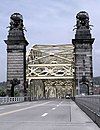
Liberty Bridge Liberty Bridge June 22, 1988 (#88000867 ) Over the Monongahela River 40°25′58″N 79°59′50″W / 40.4328°N 79.9972°W / 40.4328; -79.9972 (Liberty Bridge ) Central Business District
100
Liberty School No. 4, Friendship Building Liberty School No. 4, Friendship Building September 30, 1986 (#86002684 ) 5501 Friendship Avenue 40°27′44″N 79°56′09″W / 40.4622°N 79.9358°W / 40.4622; -79.9358 (Liberty School No. 4, Friendship Building ) Friendship
101
Lincoln Elementary School Lincoln Elementary School September 30, 1986 (#86002685 ) Lincoln and Frankstown Avenues 40°27′36″N 79°54′42″W / 40.4600°N 79.9116°W / 40.4600; -79.9116 (Lincoln Elementary School ) Larimer
102
Linden Avenue School Linden Avenue School September 30, 1986 (#86002686 ) 739 South Linden Avenue 40°26′44″N 79°55′00″W / 40.4456°N 79.9167°W / 40.4456; -79.9167 (Linden Avenue School ) Point Breeze
103
Madison Elementary School Madison Elementary School September 30, 1986 (#86002687 ) Milwaukee and Orion Streets 40°27′17″N 79°57′41″W / 40.4546°N 79.9613°W / 40.4546; -79.9613 (Madison Elementary School ) Upper Hill
104
Main Building, U.S. Bureau of Mines Main Building, U.S. Bureau of Mines May 24, 1974 (#74001741 ) 4800 Forbes Avenue 40°26′39″N 79°56′45″W / 40.4442°N 79.9458°W / 40.4442; -79.9458 (Main Building, U.S. Bureau of Mines ) Squirrel Hill North
105
Manchester Historic District Manchester Historic District September 18, 1975 (#75001611 ) Irregular pattern contained with Faulsey, Chateau, Franklin, and Bidwell Streets 40°27′15″N 80°01′29″W / 40.4542°N 80.0247°W / 40.4542; -80.0247 (Manchester Historic District ) Manchester
106
McCleary Elementary School McCleary Elementary School September 30, 1986 (#86002690 ) Holmes Street and McCandless Avenue 40°28′49″N 79°57′04″W / 40.4802°N 79.9512°W / 40.4802; -79.9512 (McCleary Elementary School ) Upper Lawrenceville
107
McCook Family Estate McCook Family Estate April 20, 2011 (#11000197 ) 5105 Fifth Avenue and 925 Amberson Avenue 40°26′53″N 79°56′18″W / 40.4481°N 79.9383°W / 40.4481; -79.9383 (McCook Family Estate ) Shadyside
108
McKees Rocks Bridge McKees Rocks Bridge November 14, 1988 (#88002168 ) Legislative Route 76, Spur 2, over the Ohio River at McKees Rocks 40°28′37″N 80°02′56″W / 40.4770°N 80.0489°W / 40.4770; -80.0489 (McKees Rocks Bridge ) Brighton Heights Extends into McKees Rocks and Stowe Township , elsewhere in Allegheny County
109
Mellon Park Mellon Park February 2, 2023 (#100008596 ) Roughly bounded by Shady, 5th, and Penn Aves; Beechwood and Bakery Square Blvds; and Mellon Park Rd. 40°27′08″N 79°55′05″W / 40.4521°N 79.9181°W / 40.4521; -79.9181 (Mellon Park ) Point Breeze , Shadyside
110
Mexican War Streets Historic District Mexican War Streets Historic District May 28, 1975 (#75001612 ) Irregular pattern between Brighton and Arch Streets and between O'Hern and West Park; also roughly bounded by Armandale Street, Carrington Street, Charlick Way, Reddour Street, and West North Avenue 40°27′24″N 80°00′45″W / 40.456667°N 80.0125°W / 40.456667; -80.0125 (Mexican War Streets Historic District ) Central Northside Second set of boundaries represents a boundary increase
111
Mifflin Elementary School Mifflin Elementary School September 30, 1986 (#86002692 ) Mifflin Road at Lincoln Place 40°22′12″N 79°54′53″W / 40.369972°N 79.914817°W / 40.369972; -79.914817 (Mifflin Elementary School ) Hays
112
Monongahela Incline Monongahela Incline June 25, 1974 (#74001742 ) Grandview Avenue at Wyoming Avenue 40°25′55″N 80°00′20″W / 40.431944°N 80.005556°W / 40.431944; -80.005556 (Monongahela Incline ) Mount Washington
113
Moreland-Hoffstot House Moreland-Hoffstot House February 23, 1978 (#78002337 ) 5057 5th Avenue 40°26′52″N 79°56′25″W / 40.447778°N 79.940278°W / 40.447778; -79.940278 (Moreland-Hoffstot House ) Shadyside
114
John Morrow Elementary School John Morrow Elementary School September 30, 1986 (#86002693 ) 1611 Davis Avenue 40°28′48″N 80°02′23″W / 40.480039°N 80.0398°W / 40.480039; -80.0398 (John Morrow Elementary School ) Brighton Heights
115
Samuel F.B. Morse School Samuel F.B. Morse School September 30, 1986 (#86002694 ) 2418 Sarah Street 40°25′37″N 79°58′15″W / 40.426867°N 79.9707°W / 40.426867; -79.9707 (Samuel F.B. Morse School ) South Side Flats
116
New Granada Theater New Granada Theater December 27, 2010 (#10001071 ) 2007–2013 Centre Avenue 40°26′39″N 79°58′48″W / 40.444028°N 79.98°W / 40.444028; -79.98 (New Granada Theater ) Middle Hill
117
Ninth Street Bridge Ninth Street Bridge January 7, 1986 (#86000019 ) Allegheny River at 9th Street40°26′48″N 80°00′01″W / 40.446667°N 80.000278°W / 40.446667; -80.000278 (Ninth Street Bridge ) Central Business District
118
Oakland Public School Oakland Public School February 3, 1987 (#86002696 ) Dawson Street near Edith Place 40°25′56″N 79°57′14″W / 40.432194°N 79.953864°W / 40.432194; -79.953864 (Oakland Public School ) South Oakland
119
Old Allegheny Rows Historic District Old Allegheny Rows Historic District November 1, 1984 (#84000349 ) Roughly bounded by Sedgwick, California, Marquis, Mero, Brighton, and Moorison Streets 40°27′34″N 80°01′09″W / 40.459461°N 80.019033°W / 40.459461; -80.019033 (Old Allegheny Rows Historic District ) California-Kirkbride
120
Old Heidelberg Apartments Old Heidelberg Apartments May 4, 1976 (#76001596 ) Braddock Avenue at Waverly Street 40°26′38″N 79°53′45″W / 40.443889°N 79.895833°W / 40.443889; -79.895833 (Old Heidelberg Apartments ) Point Breeze
121
David B. Oliver High School David B. Oliver High School February 3, 1987 (#86002698 ) Brighton Road and Island Avenue 40°27′50″N 80°01′28″W / 40.463847°N 80.024314°W / 40.463847; -80.024314 (David B. Oliver High School ) Marshall-Shadeland
122
Frederick J. Osterling Office and Studio Frederick J. Osterling Office and Studio September 5, 1985 (#85001964 ) 228 Isabella Street 40°26′54″N 80°00′06″W / 40.448333°N 80.001667°W / 40.448333; -80.001667 (Frederick J. Osterling Office and Studio ) North Shore
123
Park Place School Park Place School September 30, 1986 (#86002701 ) South Braddock and Brashear Avenues 40°26′42″N 79°53′44″W / 40.445°N 79.895556°W / 40.445; -79.895556 (Park Place School ) Point Breeze
124
Penn-Liberty Historic District Penn-Liberty Historic District November 18, 1987 (#87001995 ) Roughly bounded by Liberty Avenue, Fort Duquesne Boulevard, Stanwix, 9th, French and 10th Streets 40°26′38″N 79°59′49″W / 40.443889°N 79.996944°W / 40.443889; -79.996944 (Penn-Liberty Historic District ) Central Business District
125
Pennsylvania Railroad Bridge Pennsylvania Railroad Bridge August 13, 1979 (#79002160 ) 11th Street 40°26′58″N 79°59′50″W / 40.449444°N 79.997222°W / 40.449444; -79.997222 (Pennsylvania Railroad Bridge ) North Shore
126
Pennsylvania Railroad Station Pennsylvania Railroad Station April 22, 1976 (#76001597 ) 1101 Liberty Avenue 40°26′39″N 79°59′31″W / 40.444167°N 79.991944°W / 40.444167; -79.991944 (Pennsylvania Railroad Station ) Central Business District
127
Perry High School Perry High School September 30, 1986 (#86002702 ) Perrysville Avenue and Semicir Street 40°29′20″N 80°01′08″W / 40.488889°N 80.018889°W / 40.488889; -80.018889 (Perry High School ) Perry North
128
Phipps Conservatory Phipps Conservatory November 13, 1976 (#76001598 ) Schenley Park 40°26′19″N 79°56′52″W / 40.438611°N 79.947778°W / 40.438611; -79.947778 (Phipps Conservatory ) Central Oakland
129
Phipps-McElveen Building Phipps-McElveen Building May 5, 2000 (#00000451 ) 525–529 Penn Avenue 40°26′34″N 80°00′10″W / 40.442778°N 80.002778°W / 40.442778; -80.002778 (Phipps-McElveen Building ) Central Business District
130
Pittsburgh & Lake Erie Railroad Station Pittsburgh & Lake Erie Railroad Station January 11, 1974 (#74001743 ) Smithfield Street at Carson Street 40°26′01″N 80°00′14″W / 40.433611°N 80.003889°W / 40.433611; -80.003889 (Pittsburgh & Lake Erie Railroad Station ) South Shore
131
Pittsburgh and Lake Erie Railroad Complex Pittsburgh and Lake Erie Railroad Complex December 31, 1979 (#79002161 ) Smithfield and Carson Streets 40°26′06″N 80°00′27″W / 40.435°N 80.0075°W / 40.435; -80.0075 (Pittsburgh and Lake Erie Railroad Complex ) South Shore Now Station Square
132
Pittsburgh Athletic Association Building Pittsburgh Athletic Association Building December 15, 1978 (#78002338 ) 4215 5th Avenue 40°26′42″N 79°57′17″W / 40.445°N 79.954722°W / 40.445; -79.954722 (Pittsburgh Athletic Association Building ) Central Oakland
133
Pittsburgh Brass Manufacturing Company Building Pittsburgh Brass Manufacturing Company Building February 2, 2016 (#15001030 ) 3147–3155 Penn Ave. 40°27′39″N 79°58′13″W / 40.460833°N 79.970278°W / 40.460833; -79.970278 (Pittsburgh Brass Manufacturing Company Building ) Strip District
134
Pittsburgh Central Downtown Historic District Pittsburgh Central Downtown Historic District December 17, 1985 (#85003216 ) Roughly bounded by 4th, 6th, 7th and Liberty Avenues, former Pennsylvania Railroad tracks, Grant and Wood Streets 40°26′29″N 79°59′50″W / 40.441389°N 79.997222°W / 40.441389; -79.997222 (Pittsburgh Central Downtown Historic District ) Central Business District
135
Pittsburgh Mercantile Company Building Pittsburgh Mercantile Company Building December 29, 2014 (#14001099 ) 2600 E. Carson Street 40°25′38″N 79°58′06″W / 40.42712°N 79.968297°W / 40.42712; -79.968297 (Pittsburgh Mercantile Company Building ) South Side Flats
136
Pittsburgh Renaissance Historic District Pittsburgh Renaissance Historic District May 2, 2013 (#13000252 ) Roughly bounded by Stanwix Street, Allegheny , Monongahela and Ohio Rivers 40°26′29″N 80°00′25″W / 40.441260°N 80.006908°W / 40.441260; -80.006908 (Pittsburgh Renaissance Historic District ) Central Business District
137
Pittsburgh Terminal Warehouse and Transfer Company Pittsburgh Terminal Warehouse and Transfer Company May 8, 2013 (#13000253 ) 333–400 East Carson Street 40°25′47″N 79°59′49″W / 40.429805°N 79.997051°W / 40.429805; -79.997051 (Pittsburgh Terminal Warehouse and Transfer Company ) South Side Flats
138
Prospect Junior High and Elementary School Prospect Junior High and Elementary School September 30, 1986 (#86002705 ) Prospect Avenue near Southern Avenue 40°25′42″N 80°00′37″W / 40.4282°N 80.0102°W / 40.4282; -80.0102 (Prospect Junior High and Elementary School ) Mount Washington
139
Reymer Brothers Candy Factory Reymer Brothers Candy Factory May 30, 1997 (#97000514 ) 1425 Forbes Avenue 40°26′16″N 79°59′07″W / 40.4378°N 79.9854°W / 40.4378; -79.9854 (Reymer Brothers Candy Factory ) Bluff
140
Riverview Park Riverview Park March 1, 2021 (#100006181 ) Roughly bounded by Woods Run Ave., Mairdale Ave., Perrysville Ave., and Kilbuck St. 40°28′57″N 80°01′16″W / 40.4825°N 80.0212°W / 40.4825; -80.0212 (Riverview Park ) Perry North
141
Rodef Shalom Temple Rodef Shalom Temple November 15, 1979 (#79002162 ) 4905 5th Avenue 40°26′53″N 79°56′37″W / 40.4481°N 79.9436°W / 40.4481; -79.9436 (Rodef Shalom Temple ) Shadyside
142
Rotunda of the Pennsylvania Railroad Station Rotunda of the Pennsylvania Railroad Station April 11, 1973 (#73001587 ) 1100 Liberty Avenue at Grant Street 40°26′39″N 79°59′34″W / 40.4442°N 79.9928°W / 40.4442; -79.9928 (Rotunda of the Pennsylvania Railroad Station ) Central Business District
143
St. Boniface Roman Catholic Church St. Boniface Roman Catholic Church November 17, 1981 (#81000525 ) East Street 40°28′01″N 80°00′00″W / 40.4670°N 80.0000°W / 40.4670; -80.0000 (St. Boniface Roman Catholic Church ) Spring Hill–City View
144
St. John the Baptist Ukrainian Catholic Church St. John the Baptist Ukrainian Catholic Church October 29, 1974 (#74001747 ) 109 South 7th Street 40°25′43″N 79°59′31″W / 40.4285°N 79.9919°W / 40.4285; -79.9919 (St. John the Baptist Ukrainian Catholic Church ) South Side Flats
145
St. Stanislaus Kostka Roman Catholic Church St. Stanislaus Kostka Roman Catholic Church September 14, 1972 (#72001089 ) 21st and Smallman Streets 40°27′08″N 79°59′01″W / 40.4523°N 79.9836°W / 40.4523; -79.9836 (St. Stanislaus Kostka Roman Catholic Church ) Strip District
146
The Salvation Army Building The Salvation Army Building February 2, 2016 (#15001031 ) 425–435 Boulevard of the Allies 40°26′15″N 79°59′56″W / 40.4375°N 79.9989°W / 40.4375; -79.9989 (The Salvation Army Building ) Central Business District
147
Schenley Farms Historic District Schenley Farms Historic District July 22, 1983 (#83002213 ) Roughly bounded by Andover Terrace, Centre, Bellefield, and Parkman Avenues, Dithridge, Thackeray, Forbes and Mawhinney; also 4400 Centre Avenue 40°26′47″N 79°57′12″W / 40.4464°N 79.9533°W / 40.4464; -79.9533 (Schenley Farms Historic District ) North Oakland 4400 Centre represents a boundary increase of November 28, 2012
148
Schenley High School Schenley High School September 30, 1986 (#86002706 ) Bigelow Boulevard and Centre Avenue 40°27′01″N 79°57′17″W / 40.4503°N 79.9547°W / 40.4503; -79.9547 (Schenley High School ) North Oakland
149
Schenley Park Schenley Park November 13, 1985 (#85003506 ) Schenley Drive and Panther Hollow Road 40°26′04″N 79°56′34″W / 40.4344°N 79.9428°W / 40.4344; -79.9428 (Schenley Park ) Squirrel Hill South
150
Schiller Elementary School Schiller Elementary School September 30, 1986 (#86002707 ) 1018 Peralta Street 40°27′23″N 79°59′35″W / 40.4565°N 79.9931°W / 40.4565; -79.9931 (Schiller Elementary School ) East Allegheny
151
James Scott House James Scott House May 30, 1997 (#97000515 ) 5635 Stanton Avenue 40°28′16″N 79°55′28″W / 40.4712°N 79.9245°W / 40.4712; -79.9245 (James Scott House ) Highland Park
152
Sellers House Sellers House September 7, 1979 (#79003142 ) 400 Shady Avenue 40°27′19″N 79°55′22″W / 40.4554°N 79.9228°W / 40.4554; -79.9228 (Sellers House ) Shadyside
153
Seventh Street Bridge Seventh Street Bridge January 7, 1986 (#86000018 ) Allegheny River at 7th Street40°26′45″N 80°00′05″W / 40.4458°N 80.0014°W / 40.4458; -80.0014 (Seventh Street Bridge ) Central Business District
154
Shadyside Presbyterian Church Shadyside Presbyterian Church April 3, 1975 (#75001613 ) Amberson Avenue and Westminster Place 40°26′56″N 79°56′20″W / 40.4489°N 79.9390°W / 40.4489; -79.9390 (Shadyside Presbyterian Church ) Shadyside
155
Sixteenth Street Bridge Sixteenth Street Bridge August 13, 1979 (#79002163 ) Spans the Allegheny River 40°27′04″N 79°59′26″W / 40.4511°N 79.9906°W / 40.4511; -79.9906 (Sixteenth Street Bridge ) Central Business District
156
Sixth Street Bridge Sixth Street Bridge January 7, 1986 (#86000017 ) Allegheny River at 6th Street40°26′43″N 80°00′12″W / 40.4453°N 80.0033°W / 40.4453; -80.0033 (Sixth Street Bridge ) Central Business District
157
Smithfield Street Bridge Smithfield Street Bridge March 21, 1974 (#74001745 ) Smithfield Street at the Monongahela River 40°26′05″N 80°00′08″W / 40.4347°N 80.0022°W / 40.4347; -80.0022 (Smithfield Street Bridge ) Central Business District
158
William Penn Snyder House William Penn Snyder House May 3, 1976 (#76001599 ) 852 Ridge Avenue 40°27′01″N 80°00′57″W / 40.4503°N 80.0158°W / 40.4503; -80.0158 (William Penn Snyder House ) Allegheny West
159
Soldiers and Sailors Memorial Hall Soldiers and Sailors Memorial Hall December 30, 1974 (#74001746 ) 5th Avenue at Bigelow Boulevard 40°26′43″N 79°57′23″W / 40.445278°N 79.956389°W / 40.445278; -79.956389 (Soldiers and Sailors Memorial Hall ) North Oakland
160
South Side High School South Side High School September 30, 1986 (#86002709 ) 900 East Carson Street 40°25′42″N 79°59′20″W / 40.428378°N 79.988844°W / 40.428378; -79.988844 (South Side High School ) South Side Flats
161
South Side Market Building South Side Market Building October 14, 1976 (#76001600 ) 12th and Bingham Streets 40°25′46″N 79°59′11″W / 40.429344°N 79.986436°W / 40.429344; -79.986436 (South Side Market Building ) South Side Flats
162
South Tenth Street Bridge South Tenth Street Bridge January 7, 1986 (#86000020 ) Monongahela River at S. 10th Street40°25′57″N 79°59′23″W / 40.4325°N 79.989722°W / 40.4325; -79.989722 (South Tenth Street Bridge ) Bluff
163
Springfield Public School Springfield Public School September 30, 1986 (#86002711 ) Smallman and 31st Streets 40°27′36″N 79°58′20″W / 40.4601°N 79.9723°W / 40.4601; -79.9723 (Springfield Public School ) Strip District
164
Stanley Theater and Clark Building Stanley Theater and Clark Building February 27, 1986 (#86000303 ) 207 7th Street and 701–717 Liberty Avenue 40°26′35″N 80°00′00″W / 40.443056°N 80.0°W / 40.443056; -80.0 (Stanley Theater and Clark Building ) Central Business District
165
Sterrett Sub-District School Sterrett Sub-District School September 30, 1986 (#86002713 ) 339 Lang Avenue 40°26′48″N 79°54′20″W / 40.446592°N 79.905419°W / 40.446592; -79.905419 (Sterrett Sub-District School ) Point Breeze
166
Strip Historic District Strip Historic District May 2, 2014 (#14000194 ) Roughly bounded by former Pennsylvania Railroad yards, Liberty Avenue, Railroad, 22nd and 15th Streets 40°27′00″N 79°59′06″W / 40.450°N 79.985°W / 40.450; -79.985 (Strip Historic District ) Strip District
167
Teutonia Maennerchor Hall Teutonia Maennerchor Hall May 14, 2004 (#04000439 ) 857 Phineas Street 40°27′19″N 79°59′42″W / 40.455219°N 79.995°W / 40.455219; -79.995 (Teutonia Maennerchor Hall ) East Allegheny
168
Try Street Terminal Try Street Terminal December 28, 2007 (#07001327 ) 600–620 2nd Avenue 40°26′09″N 79°59′45″W / 40.435833°N 79.995833°W / 40.435833; -79.995833 (Try Street Terminal ) Central Business District
169
Tuberculosis Hospital of Pittsburgh Tuberculosis Hospital of Pittsburgh February 25, 1993 (#93000073 ) 2851 Bedford Avenue 40°27′12″N 79°58′07″W / 40.453283°N 79.968689°W / 40.453283; -79.968689 (Tuberculosis Hospital of Pittsburgh ) Bedford Dwellings
170
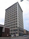
Union Trust Building Union Trust Building January 21, 1974 (#74001748 ) 435 Grant Street 40°26′23″N 79°59′48″W / 40.439722°N 79.996667°W / 40.439722; -79.996667 (Union Trust Building ) Central Business District
171
US Post Office and Courthouse-Pittsburgh US Post Office and Courthouse-Pittsburgh February 2, 1995 (#94001620 ) 700 Grant St.[ 5] 40°26′33″N 79°59′40″W / 40.4425°N 79.994444°W / 40.4425; -79.994444 (US Post Office and Courthouse-Pittsburgh ) Central Business District
172
Ursuline Young Ladies Academy Ursuline Young Ladies Academy September 4, 2012 (#12000604 ) 201 South Winebiddle Street 40°27′51″N 79°56′32″W / 40.464072°N 79.942282°W / 40.464072; -79.942282 (Ursuline Young Ladies Academy ) Bloomfield
173
Washington Vocational School Washington Vocational School September 30, 1986 (#86002715 ) 169 40th Street 40°28′10″N 79°57′47″W / 40.469444°N 79.963056°W / 40.469444; -79.963056 (Washington Vocational School ) Central Lawrenceville
174
West End-North Side Bridge West End-North Side Bridge August 24, 1979 (#79003143 ) Western Avenue and Carson Street 40°26′53″N 80°01′35″W / 40.448056°N 80.026389°W / 40.448056; -80.026389 (West End-North Side Bridge ) Chateau
175
Western State Penitentiary-Riverside Penitentiary Western State Penitentiary-Riverside Penitentiary February 14, 2022 (#100007417 ) 3001 New Beaver Ave. 40°28′12″N 80°02′21″W / 40.4699°N 80.0391°W / 40.4699; -80.0391 (Western State Penitentiary-Riverside Penitentiary ) Marshall-Shadeland
176
Westinghouse High School Westinghouse High School September 30, 1986 (#86002716 ) 1101 North Murtland Street 40°27′39″N 79°54′04″W / 40.460833°N 79.901211°W / 40.460833; -79.901211 (Westinghouse High School ) Homewood West
177
Whitehill-Gleason Motors Whitehill-Gleason Motors July 22, 1999 (#99000878 ) 5815 Baum Boulevard 40°27′35″N 79°55′49″W / 40.459722°N 79.930278°W / 40.459722; -79.930278 (Whitehill-Gleason Motors ) East Liberty
178
Wightman School Wightman School September 30, 1986 (#86002717 ) 5604 Solway Street 40°26′34″N 79°55′36″W / 40.442689°N 79.926675°W / 40.442689; -79.926675 (Wightman School ) Squirrel Hill North
179
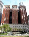
William Penn Hotel William Penn Hotel March 7, 1985 (#85000458 ) Mellon Square between 6th and Oliver Streets 40°26′25″N 79°59′46″W / 40.440278°N 79.996111°W / 40.440278; -79.996111 (William Penn Hotel ) Central Business District
180
August Wilson House August Wilson House April 30, 2013 (#13000254 ) 1727 Bedford Avenue 40°26′43″N 79°59′08″W / 40.445281°N 79.985557°W / 40.445281; -79.985557 (August Wilson House ) Crawford-Roberts
181
John Woods House John Woods House April 29, 1993 (#93000353 ) 4604 Monongahela Street 40°24′53″N 79°56′41″W / 40.414744°N 79.944617°W / 40.414744; -79.944617 (John Woods House ) Hazelwood
182
Woolslair Elementary School Woolslair Elementary School September 30, 1986 (#86002718 ) 40th Street and Liberty Avenue 40°27′48″N 79°57′26″W / 40.4633°N 79.9572°W / 40.4633; -79.9572 (Woolslair Elementary School ) Lower Lawerenceville


