Crusc de Rit
Appearance
(Redirected from Kreuzspitze (South Tyrol))
You can help expand this article with text translated from the corresponding article in German. (December 2022) Click [show] for important translation instructions.
|
| Crusc de Rit | |
|---|---|
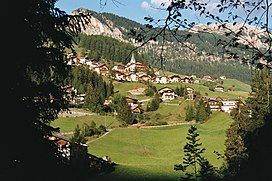
 Crusc de Rit to the left | |
| Highest point | |
| Elevation | 2,021 m (6,631 ft) |
| Coordinates | 46°39′54″N 11°57′18″E / 46.66500°N 11.95500°E |
| Geography | |
 | |
| Location | South Tyrol, Italy |
| Parent range | Dolomites |
The Crusc de Rit (Italian: Monte Croce [ˈmonte ˈkroːtʃe]; German: Kreuzspitze) is a mountain in the Dolomites in South Tyrol, Italy.
References
[edit]- Alpenverein South Tyrol (in German)
External links
[edit]Wikimedia Commons has media related to Crusc de Rit.
