File:Xixiasaurus map.jpg
Appearance

Size of this preview: 800 × 558 pixels. Other resolutions: 320 × 223 pixels | 640 × 446 pixels | 1,024 × 714 pixels | 1,280 × 893 pixels | 2,916 × 2,034 pixels.
Original file (2,916 × 2,034 pixels, file size: 1.76 MB, MIME type: image/jpeg)
File history
Click on a date/time to view the file as it appeared at that time.
| Date/Time | Thumbnail | Dimensions | User | Comment | |
|---|---|---|---|---|---|
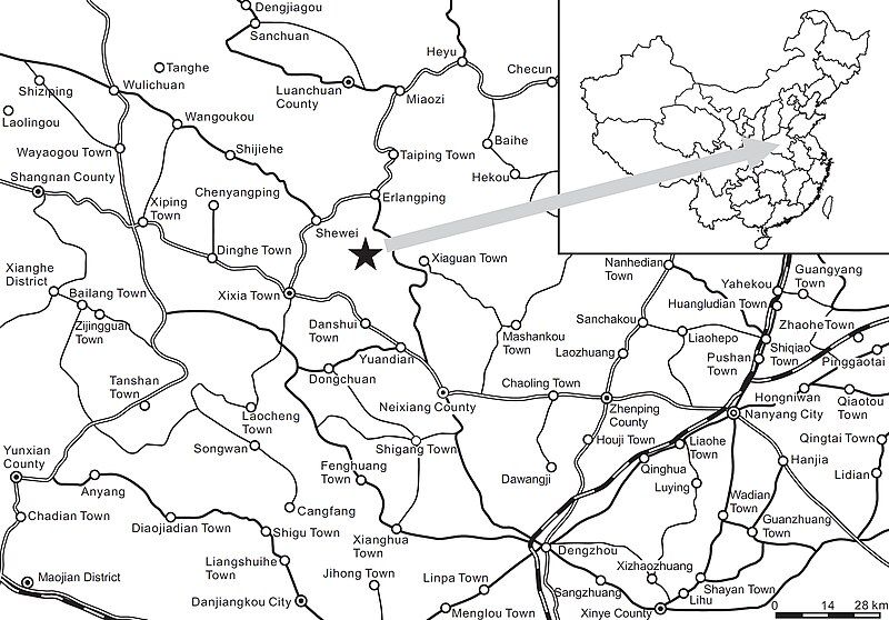
| current | 00:57, 4 December 2018 |  | 2,916 × 2,034 (1.76 MB) | FunkMonk | {{Information |Description=The type locality of Xixiasaurus henanensis gen. et sp. nov.; lower to middle part of the Majiacun Formation (Upper Cretaceous: Coniacian–Campanian). The solid pentagon represents the fossil site near Songgou Village, Henan Province. |Source=http://app.pan.pl/article/item/app20090047.html |Date=2010 |Author=Junchang Lü, Li Xu, Yongqing Liu, Xingliao Zhang, Songhai Jia, and Qiang Ji |Permission={{cc-by-2.0}} This image was published in ''[[:en:Acta_Palaeontologica_Po... |
File usage
The following page uses this file:
Global file usage
The following other wikis use this file:
- Usage on el.wikipedia.org
- Usage on es.wikipedia.org
- Usage on fr.wikipedia.org
