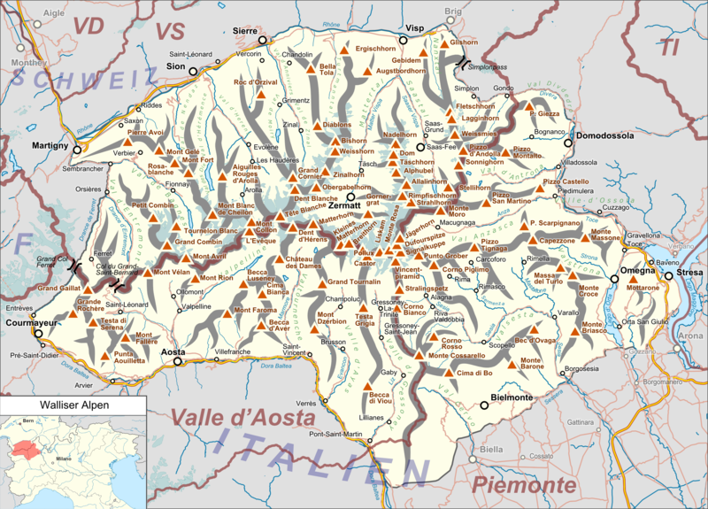
File:Walliser Alpen.png
Appearance

Size of this preview: 800 × 575 pixels. Other resolutions: 320 × 230 pixels | 640 × 460 pixels | 1,024 × 736 pixels | 1,280 × 920 pixels | 2,412 × 1,733 pixels.
Original file (2,412 × 1,733 pixels, file size: 2.28 MB, MIME type: image/png)
File history
Click on a date/time to view the file as it appeared at that time.
| Date/Time | Thumbnail | Dimensions | User | Comment | |
|---|---|---|---|---|---|
| current | 18:09, 3 April 2022 |  | 2,412 × 1,733 (2.28 MB) | Zacharie Grossen | fix weird location map (both countries should be in yellow, not just Italy) |
| 19:31, 12 October 2016 |  | 2,412 × 1,733 (2.32 MB) | Pechristener | location map added | |
| 18:49, 12 October 2016 |  | 2,412 × 1,733 (2.27 MB) | Pechristener | {{Map |Description={{de|1=Lagekarte des de:Walliser Alpen}} |Source ={{own}} Map was created using: *[http://www.openstreetmap.org/ Open Street Map] <!-- *Switzerland location map.svg for location... |
File usage
The following page uses this file:
Global file usage
The following other wikis use this file:
- Usage on de.wikipedia.org
- Matterhorn
- Dufourspitze
- Monte Rosa
- Walliser Alpen
- Mominggletscher
- Ober Gabelhorn
- Strahlhorn
- Lac de Moiry
- Signalkuppe
- Bella Tola
- Capanna Regina Margherita
- Grand Cornier
- Seetalhorn
- Grüensee (Zermatt)
- Almagellerhütte
- Mattertal
- Capanna Gnifetti
- Rifugio Quintino Sella (Felikjoch)
- Rifugio Prarayer
- Rifugio Nacamuli al Col Collon
- Rifugio Aosta
- Rifugio Elena
- Rifugio Perucca-Vuillermoz
- Rifugio Barmasse
- Rifugio Duca degli Abruzzi all’Oriondé
- Rifugio Guide della Val d’Ayas
- Rifugio Guide del Cervino
- Rifugio Franco Chiarella all’Amianthe
- Rifugio Giorgio Bertone
- Rifugio Oratorio di Cunéy
- Cabane du Mountet
- Fluchthorn (Walliser Alpen)
- Corne de Sorebois
- Turtmannhütte
- Lacs de Fenêtre
- Fenêtre de Durand
- Weisshorngruppe
- Vorlage:Positionskarte Walliser Alpen
- Liste der Gebirgsgruppen in den Westalpen
- Cabane Arpitettaz
- Refuge des Bouquetins
- Bivouac de l’Aiguillette à la Singla
- Bivouac au Col de la Dent Blanche
- Cresta-Biwak
- Bivouac du Dolent-La Maye
- Mischabeljochbiwak
- Schalijochbiwak
- Bivacco Biagio Musso
- Col Nord de Menouve
- Benutzer Diskussion:Pechristener/Alpenkarten
View more global usage of this file.

