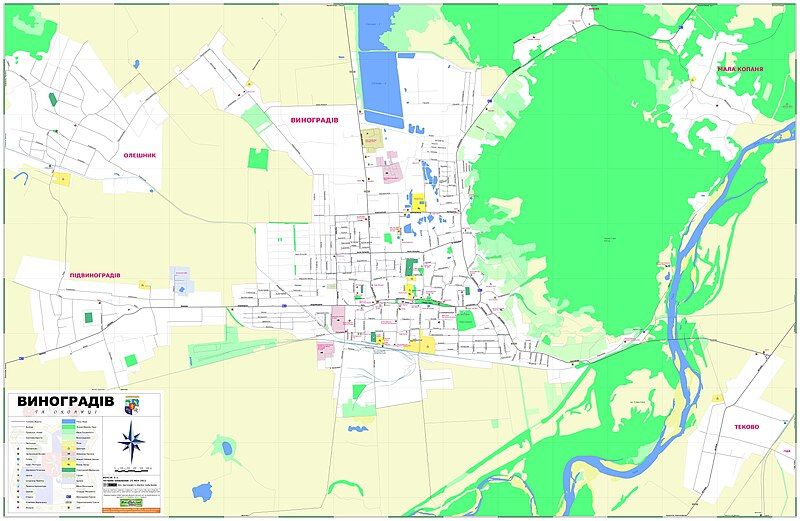
File:Vynohradiv Map.jpg
Appearance

Size of this preview: 800 × 521 pixels. Other resolutions: 320 × 209 pixels | 640 × 417 pixels | 1,024 × 667 pixels | 1,280 × 834 pixels | 2,560 × 1,669 pixels | 7,283 × 4,747 pixels.
Original file (7,283 × 4,747 pixels, file size: 2.57 MB, MIME type: image/jpeg)
File history
Click on a date/time to view the file as it appeared at that time.
| Date/Time | Thumbnail | Dimensions | User | Comment | |
|---|---|---|---|---|---|
| current | 04:20, 26 November 2011 |  | 7,283 × 4,747 (2.57 MB) | Vasiliymeshko | Some street updates for Vynohradiv. Added street names to Pidvynohradiv and Oleshnik (not complete yet). |
| 05:37, 10 February 2011 |  | 7,283 × 4,747 (3.05 MB) | Vasiliymeshko | Map Version 3.0 with street numbering, misc. updates and corrections | |
| 03:18, 12 January 2011 |  | 7,283 × 4,747 (2.3 MB) | Vasiliymeshko | New streets, & misc street labels update | |
| 07:11, 17 December 2010 |  | 7,283 × 4,747 (2.29 MB) | Vasiliymeshko | Misc. Map updates | |
| 22:42, 14 December 2010 |  | 7,283 × 4,747 (2.29 MB) | Vasiliymeshko | Misc. map updates | |
| 14:26, 10 December 2010 |  | 7,283 × 4,747 (2.94 MB) | Vasiliymeshko | ||
| 18:33, 10 August 2010 |  | 7,283 × 4,747 (2.85 MB) | Vasiliymeshko | {{Information |Description= Street map of Vynohradiv area, Ukraine, created using various sources |Source={{own}} |Date= 8/01/10 |Author= Vasiliymeshko |Permission= |other_versions= }} |
File usage
The following page uses this file:
Global file usage
The following other wikis use this file:
- Usage on it.wikipedia.org
- Usage on nl.wikipedia.org
- Usage on ru.wikipedia.org
- Usage on uk.wikipedia.org
- Usage on uz.wikipedia.org
- Usage on zh.wikipedia.org
