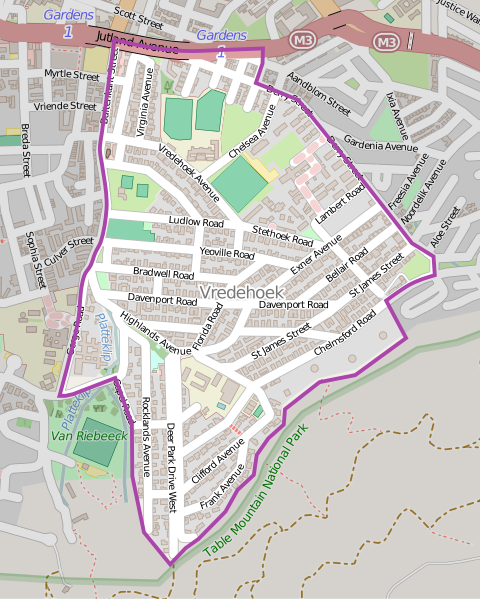
File:Vredehoek OSM map.svg
Appearance

Size of this PNG preview of this SVG file: 480 × 599 pixels. Other resolutions: 192 × 240 pixels | 385 × 480 pixels | 615 × 768 pixels | 820 × 1,024 pixels | 1,641 × 2,048 pixels | 496 × 619 pixels.
Original file (SVG file, nominally 496 × 619 pixels, file size: 2.37 MB)
File history
Click on a date/time to view the file as it appeared at that time.
| Date/Time | Thumbnail | Dimensions | User | Comment | |
|---|---|---|---|---|---|
| current | 12:49, 16 October 2015 |  | 496 × 619 (2.37 MB) | Htonl | {{OpenStreetMap |odbl=yes |location=Vredehoek |category=|left=18.4155 |bottom=-33.9485 |right=18.4305 |top=-33.933}} Category:OpenStreetMap maps of South Africa Category:Maps of Cape Town suburbs |
File usage
The following page uses this file:
Global file usage
The following other wikis use this file:

