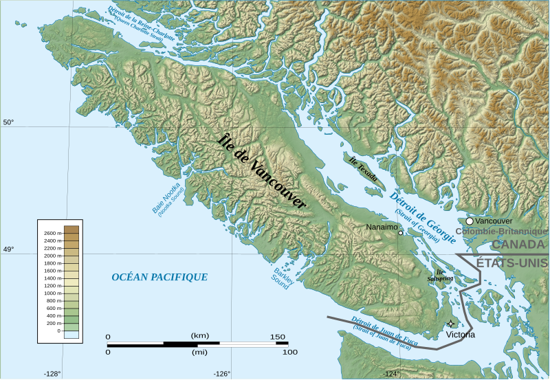
File:Vancouver Island Map-fr.svg
Appearance

Size of this PNG preview of this SVG file: 800 × 552 pixels. Other resolutions: 320 × 221 pixels | 640 × 442 pixels | 1,024 × 707 pixels | 1,280 × 883 pixels | 2,560 × 1,767 pixels | 1,249 × 862 pixels.
Original file (SVG file, nominally 1,249 × 862 pixels, file size: 5.14 MB)
File history
Click on a date/time to view the file as it appeared at that time.
| Date/Time | Thumbnail | Dimensions | User | Comment | |
|---|---|---|---|---|---|
| current | 21:39, 27 July 2008 |  | 1,249 × 862 (5.14 MB) | Arct | {{Information |Description= |Source= |Date= |Author= |Permission= |other_versions= }} |
| 17:03, 27 July 2008 |  | 1,244 × 860 (5.13 MB) | Arct | {{Information |Description={{en|1=Map of the en:Vancouver Island in en:British-Columbia (en:Canada)}} {{fr|1=Carte de l'fr:Île de Vancouver en fr:Colombie-Britannique (fr:Canada)}} |Source=travail personnel (own work) |
File usage
The following page uses this file:
Global file usage
The following other wikis use this file:
- Usage on bg.wikipedia.org
- Usage on ca.wikipedia.org
- Usage on es.wikipedia.org
- Usage on fr.wikipedia.org
- Usage on it.wikipedia.org
- Usage on oc.wikipedia.org
- Usage on ru.wikipedia.org
- Usage on sh.wikipedia.org
- Usage on sl.wikipedia.org
- Usage on sr.wikipedia.org
- Usage on zh-min-nan.wikipedia.org

