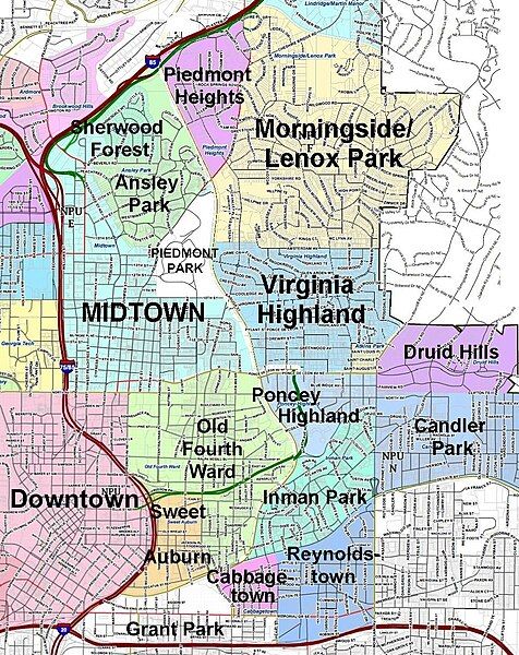
File:VaHiInEastCentralAtlanta.jpg
Appearance

Size of this preview: 476 × 600 pixels. Other resolutions: 190 × 240 pixels | 381 × 480 pixels | 967 × 1,218 pixels.
Original file (967 × 1,218 pixels, file size: 657 KB, MIME type: image/jpeg)
File history
Click on a date/time to view the file as it appeared at that time.
| Date/Time | Thumbnail | Dimensions | User | Comment | |
|---|---|---|---|---|---|
| current | 16:01, 17 August 2017 |  | 967 × 1,218 (657 KB) | Keizers | Removed lines around Virginia Highland so can be used for all neighborhoods |
| 15:39, 24 January 2011 |  | 967 × 1,218 (706 KB) | Keizers | {{Information |Description ={{en|1=map of intown Atlanta showing Virginia Highland}} |Source =US government |Author =US goverment and self |Date =2011-01-24 |Permission = |other_versions = }} Category:Maps [[Category: |
File usage
The following 2 pages use this file:
Global file usage
The following other wikis use this file:
- Usage on azb.wikipedia.org
- Usage on ca.wikipedia.org
- Usage on www.wikidata.org

