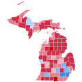
File:2016 United States presidential election results map by county.svg
Appearance

Size of this PNG preview of this SVG file: 542 × 334 pixels. Other resolutions: 320 × 197 pixels | 640 × 394 pixels | 1,024 × 631 pixels | 1,280 × 789 pixels | 2,560 × 1,578 pixels.
Original file (SVG file, nominally 542 × 334 pixels, file size: 13.32 MB)
File history
Click on a date/time to view the file as it appeared at that time.
| Date/Time | Thumbnail | Dimensions | User | Comment | |
|---|---|---|---|---|---|
| current | 08:07, 13 December 2024 |  | 542 × 334 (13.32 MB) | Gordfather69 | Fix |
| 04:45, 30 November 2024 |  | 542 × 334 (13.32 MB) | Gordfather69 | Fix | |
| 19:26, 27 November 2024 |  | 542 × 334 (13.32 MB) | Gordfather69 | Update | |
| 23:04, 3 March 2023 |  | 555 × 352 (1.74 MB) | Gordfather69 | line width | |
| 05:37, 1 December 2019 |  | 555 × 352 (1.73 MB) | SpeedMcCool | Fixed Tazewell County, Illinois | |
| 16:06, 21 November 2019 |  | 555 × 352 (1.73 MB) | SpeedMcCool | Updated McCone County Montana | |
| 01:13, 11 October 2019 |  | 555 × 352 (1.73 MB) | SpeedMcCool | Fixed Potter and Lehigh Counties PA | |
| 21:50, 27 October 2018 |  | 555 × 352 (1.73 MB) | Vartemp | Fixed shading for McDonald County, MO. | |
| 16:16, 29 July 2017 |  | 555 × 352 (1.73 MB) | Inqvisitor | Two county shading corrections | |
| 16:41, 15 February 2017 |  | 555 × 352 (1.74 MB) | Jayjay8990 | Reverted to version as of 05:49, 8 February 2017 (UTC) |
File usage
The following 4 pages use this file:
Global file usage
The following other wikis use this file:
- Usage on ar.wikipedia.org
- Usage on bg.wikipedia.org
- Usage on ca.wikipedia.org
- Usage on cs.wikipedia.org
- Usage on de.wikipedia.org
- Usage on fa.wikipedia.org
- Usage on fr.wikipedia.org
- Usage on hu.wikipedia.org
- Usage on nl.wikipedia.org
- Usage on no.wikipedia.org
- Usage on pa.wikipedia.org
- Usage on zh.wikipedia.org


