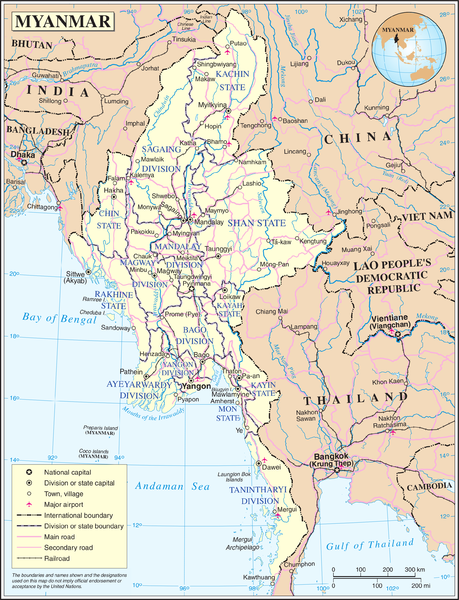
File:Un-myanmar.png
Appearance

Size of this preview: 459 × 600 pixels. Other resolutions: 184 × 240 pixels | 367 × 480 pixels | 588 × 768 pixels | 783 × 1,024 pixels | 2,366 × 3,092 pixels.
Original file (2,366 × 3,092 pixels, file size: 1.83 MB, MIME type: image/png)
File history
Click on a date/time to view the file as it appeared at that time.
| Date/Time | Thumbnail | Dimensions | User | Comment | |
|---|---|---|---|---|---|
| current | 21:11, 13 May 2008 |  | 2,366 × 3,092 (1.83 MB) | Mahahahaneapneap | Compressed |
| 01:36, 24 October 2007 |  | 2,366 × 3,092 (2.42 MB) | Jeroen | Map of Myanmar. Based on the UN map, but the location capital has been updated by me (the original uploader). {{UN map}} Category:Maps of Myanmar |
File usage
The following 4 pages use this file:
Global file usage
The following other wikis use this file:
- Usage on az.wikipedia.org
- Usage on bn.wikipedia.org
- Usage on fi.wikipedia.org
- Usage on fr.wikipedia.org
- Usage on gl.wikipedia.org
- Usage on id.wikipedia.org
- Usage on kg.wikipedia.org
- Usage on pl.wiktionary.org
- Usage on shn.wikipedia.org
- Usage on simple.wikipedia.org
- Usage on si.wikipedia.org
- Usage on sl.wikipedia.org
- Usage on th.wikipedia.org
- Usage on uk.wikipedia.org
- Usage on zh.wikipedia.org

