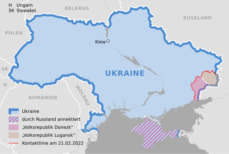
File:Ukraine 2022-02-21.svg
Appearance

Size of this PNG preview of this SVG file: 800 × 537 pixels. Other resolutions: 320 × 215 pixels | 640 × 430 pixels | 1,024 × 688 pixels | 1,280 × 859 pixels | 2,560 × 1,719 pixels | 1,546 × 1,038 pixels.
Original file (SVG file, nominally 1,546 × 1,038 pixels, file size: 452 KB)
File history
Click on a date/time to view the file as it appeared at that time.
| Date/Time | Thumbnail | Dimensions | User | Comment | |
|---|---|---|---|---|---|
| current | 15:34, 27 February 2022 |  | 1,546 × 1,038 (452 KB) | NordNordWest | Reverted to version as of 14:40, 25 February 2022 (UTC); nein danke |
| 20:31, 26 February 2022 |  | 1,546 × 1,038 (492 KB) | Kematen | Donezk weiter westlich | |
| 19:51, 25 February 2022 |  | 1,546 × 1,038 (492 KB) | Kematen | übersichtlicher | |
| 14:40, 25 February 2022 |  | 1,546 × 1,038 (452 KB) | NordNordWest | c | |
| 14:38, 25 February 2022 |  | 1,546 × 1,038 (450 KB) | NordNordWest | c | |
| 21:40, 24 February 2022 |  | 1,546 × 1,038 (442 KB) | NordNordWest | == {{int:filedesc}} == {{Information |description= {{de|1=Karte der Ukraine, Stand 21. Februar 2022}} |source={{Own using|Ukraine adm location map.svg|by=NordNordWest}} * https://www.osce.org/files/b/c/map_settlements--2022-02-20.jpg?itok=82567= |date={{Date|2022|02|24}} |author={{U|NordNordWest}} |permission= |other_versions= }} {{Kartenwerkstatt}} == {{int:license-header}} == {{User:NordNordWest/LicenceMap}} Category:Maps of the Russo-Ukrainian war Category:SVG maps of Ukraine [[... |
File usage
The following page uses this file:
Global file usage
The following other wikis use this file:
- Usage on als.wikipedia.org
- Usage on de.wikipedia.org


