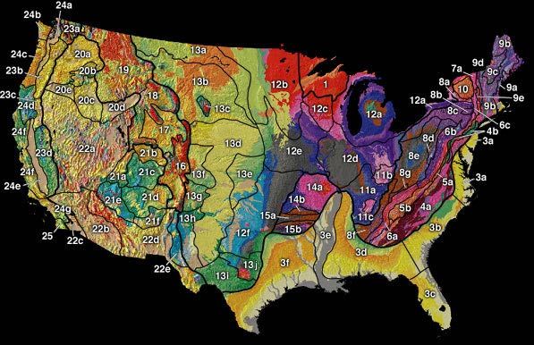
File:US physiographic regions map.jpg
Appearance
US_physiographic_regions_map.jpg (597 × 386 pixels, file size: 66 KB, MIME type: image/jpeg)
File history
Click on a date/time to view the file as it appeared at that time.
| Date/Time | Thumbnail | Dimensions | User | Comment | |
|---|---|---|---|---|---|
| current | 16:50, 20 April 2008 |  | 597 × 386 (66 KB) | File Upload Bot (Magnus Manske) | {{BotMoveToCommons|en.wikipedia}} {{Information |Description={{en|[http://tapestry.usgs.gov/physiogr/physio.html]}} |Source=Transferred from [http://en.wikipedia.org en.wikipedia] |Date=2003-02-10 (original upload date) |Author=Original uploader was [[:e |
File usage
The following 2 pages use this file:
Global file usage
The following other wikis use this file:
- Usage on ar.wikipedia.org
- Usage on cs.wikipedia.org
- Velké planiny
- Skalnaté hory
- Vnitřní roviny
- Atlantská nížina
- Geografie Spojených států amerických
- Fyzická geografie Spojených států amerických
- Highland Rim
- Nashvillská pánev
- Wyomingská pánev
- Canyon Lands
- Vysoké plošiny
- Navajská oblast
- Datilská oblast
- Nížina Mexického zálivu
- Vnitřní vysočiny
- Bostonské hory
- Pobřežní nížina
- Usage on es.wikipedia.org
- Usage on fr.wikipedia.org
- Usage on it.wikipedia.org
- Usage on nn.wikipedia.org
- Usage on pl.wikipedia.org
- Usage on pt.wikipedia.org
- Usage on simple.wikipedia.org
- Usage on tr.wikipedia.org


