Jump to content

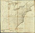
File:USPostRoadMap1796.jpg

Page contents not supported in other languages.
This is a file from the Wikimedia Commons
From Wikipedia, the free encyclopedia

Original file (11,513 × 10,762 pixels, file size: 35.24 MB, MIME type: image/jpeg)

Warning The original file is very high-resolution. It might not load properly or could cause your browser to freeze when opened at full size. Open in ZoomViewer

Summary

Description
English: Map of the United States exhibiting post-roads, the situations, connections & distances of the post-offices, stage roads, counties, ports of entry and delivery for foreign vessels, and the principal rivers; scale [ca. 1:2,400,000]; Relief shown pictorially. Prime meridian: Washington, D.C. Handwritten on slip of paper affixed to map verso: "No. 154, title page of Map of United States deposited by Abm. Bradley junr. as author, Sept. 26th 1796." "W. Barker, sculp. Philad." Sheets joined to form 1 map. Includes mail transportation chart and text. Fold-lined, some brown coloration along folds. Some annotations in pencil. Copy imperfect: Sheet sectioned vertically in half.
Date
Source Library of Congress digital collection: http://memory.loc.gov/cgi-bin/query/h?ammem/gmd:@field(NUMBER+@band(g3700+ct001192))
Author Abraham Bradley, Jr.

Licensing

Public domain This work is from the Library of Congress. According to the library, there are no known copyright restrictions on the use of this work.

Captions

Add a one-line explanation of what this file represents

Items portrayed in this file

depicts

26 September 1796Gregorian

36,955,934 byte

10,762 pixel

11,513 pixel

image/jpeg

235d78425ec9a6615b0bfe517e5488c78993cf8d

File history

Click on a date/time to view the file as it appeared at that time.

Date/TimeThumbnailDimensionsUserComment
current17:18, 14 June 2009Thumbnail for version as of 17:18, 14 June 200911,513 × 10,762 (35.24 MB)BusterD{{Information |Description={{en|1=Map of the United States exhibiting post-roads, the situations, connections & distances of the post-offices, stage roads, counties, ports of entry and delivery for foreign vessels, and the principal rivers; scale [ca. 1:2

Metadata