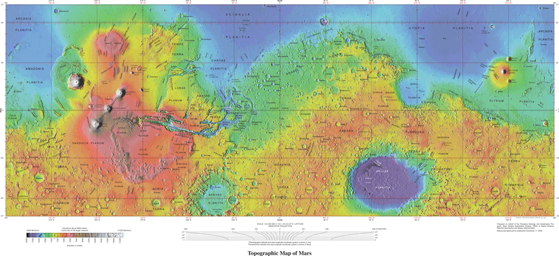
File:USGS-PlanetMars-TopographicalMap.png
Appearance

Size of this preview: 800 × 367 pixels. Other resolutions: 320 × 147 pixels | 640 × 294 pixels | 1,024 × 470 pixels | 1,280 × 587 pixels | 2,560 × 1,174 pixels | 10,292 × 4,720 pixels.
Original file (10,292 × 4,720 pixels, file size: 6.72 MB, MIME type: image/png)
File history
Click on a date/time to view the file as it appeared at that time.
| Date/Time | Thumbnail | Dimensions | User | Comment | |
|---|---|---|---|---|---|
| current | 18:11, 4 October 2021 |  | 10,292 × 4,720 (6.72 MB) | Cherurbino | same 256 clr, larger size + legend |
| 00:19, 16 May 2019 |  | 7,245 × 3,204 (11.38 MB) | Huntster | Crop from original, manually trim out right side text, push title text up a bit. | |
| 02:14, 15 May 2019 |  | 3,472 × 1,544 (7.43 MB) | Drbogdan | User created page with UploadWizard |
File usage
The following 2 pages use this file:
Global file usage
The following other wikis use this file:
- Usage on el.wikipedia.org
- Usage on fr.wikipedia.org
- Usage on hr.wikipedia.org
- Usage on ru.wikipedia.org
- Usage on vi.wikipedia.org


