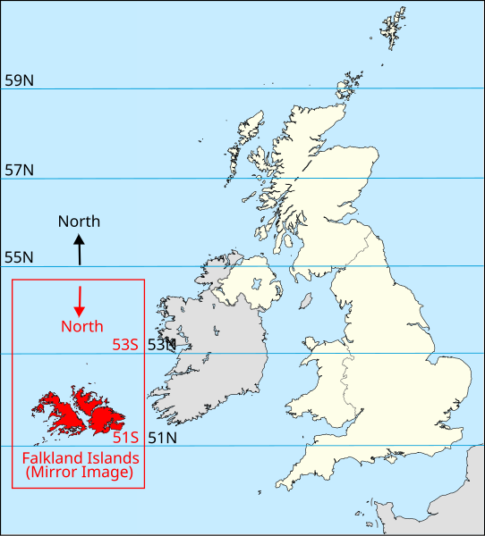
File:UK Falklands comparison.svg
Appearance

Size of this PNG preview of this SVG file: 542 × 600 pixels. Other resolutions: 217 × 240 pixels | 434 × 480 pixels | 694 × 768 pixels | 925 × 1,024 pixels | 1,851 × 2,048 pixels | 1,240 × 1,372 pixels.
Original file (SVG file, nominally 1,240 × 1,372 pixels, file size: 832 KB)
File history
Click on a date/time to view the file as it appeared at that time.
| Date/Time | Thumbnail | Dimensions | User | Comment | |
|---|---|---|---|---|---|
| current | 09:19, 24 March 2014 |  | 1,240 × 1,372 (832 KB) | Martinvl | Scaled Falkland Islands map in the x-direction by a factor of sin(50) to compensate for projection of original image |
| 20:52, 24 October 2012 |  | 1,240 × 1,372 (874 KB) | Martinvl | Reverted to version as of 20:50, 24 October 2012 - old file appears to have overwritten a new file | |
| 20:50, 24 October 2012 |  | 1,240 × 1,372 (874 KB) | Martinvl | The map of the Falklands has been inverted as per description | |
| 20:50, 24 October 2012 |  | 1,240 × 1,372 (874 KB) | Martinvl | The map of the Falklands has been inverted as per description | |
| 20:41, 24 October 2012 |  | 1,240 × 1,372 (874 KB) | Martinvl | Map of Falkland Islands replaced with a mirror image | |
| 20:47, 22 October 2012 |  | 1,240 × 1,372 (874 KB) | Martinvl | User created page with UploadWizard |
File usage
The following 2 pages use this file:
Global file usage
The following other wikis use this file:
- Usage on uk.wikipedia.org
