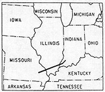
File:Tri-State Tornado trackmap cropped.png
Appearance
Tri-State_Tornado_trackmap_cropped.png (366 × 320 pixels, file size: 33 KB, MIME type: image/png)
File history
Click on a date/time to view the file as it appeared at that time.
| Date/Time | Thumbnail | Dimensions | User | Comment | |
|---|---|---|---|---|---|
| current | 00:21, 15 November 2006 |  | 366 × 320 (33 KB) | Dual Freq | {{Information |Description=A map of the track of the 219-mile, 3.5 hour Tri-State Tornado which killed 695 in Missouri, Illinois, and Indiana on 18 March 1925. |Source=http://www.crh.noaa.gov/pah/1925/tt_body.php |Date=Cropped November 14, 2006 |Author=Or |
File usage
The following 4 pages use this file:
Global file usage
The following other wikis use this file:
- Usage on el.wikipedia.org
- Usage on es.wikipedia.org
- Usage on pt.wikipedia.org
- Usage on ru.wikipedia.org


