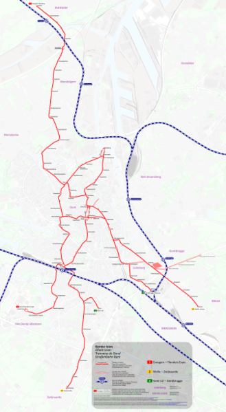
File:Tramnet Gent geografisch.png
Appearance

Size of this preview: 329 × 600 pixels. Other resolutions: 131 × 240 pixels | 263 × 480 pixels | 421 × 768 pixels | 561 × 1,024 pixels | 1,123 × 2,048 pixels | 3,035 × 5,534 pixels.
Original file (3,035 × 5,534 pixels, file size: 9.29 MB, MIME type: image/png)
File history
Click on a date/time to view the file as it appeared at that time.
| Date/Time | Thumbnail | Dimensions | User | Comment | |
|---|---|---|---|---|---|
| current | 15:51, 21 October 2017 |  | 3,035 × 5,534 (9.29 MB) | Metrophil | New background map, fixed errors |
| 16:58, 20 October 2017 |  | 4,047 × 7,378 (15.63 MB) | Metrophil | {{Information |Description ={{en|1=Geographic tram map of Ghent, Belgium as of 2017.}} {{de|1=Geographische Karte des Straßenbahnnetzes in Gent, Belgien mit dem Stand 2017.}} {{nl|1=Geographisch kaart van het Gentse tram netwerk, België 2017.}} {{... |
File usage
The following page uses this file:
Global file usage
The following other wikis use this file:
- Usage on fa.wikipedia.org
- Usage on fr.wikipedia.org
- Usage on id.wikipedia.org
- Usage on ja.wikipedia.org
- Usage on lv.wikipedia.org


