File:Topo Map Pennines.png
Appearance

Size of this preview: 415 × 599 pixels. Other resolutions: 166 × 240 pixels | 333 × 480 pixels | 532 × 768 pixels | 1,250 × 1,803 pixels.
Original file (1,250 × 1,803 pixels, file size: 3.2 MB, MIME type: image/png)
File history
Click on a date/time to view the file as it appeared at that time.
| Date/Time | Thumbnail | Dimensions | User | Comment | |
|---|---|---|---|---|---|
| current | 09:09, 25 September 2020 |  | 1,250 × 1,803 (3.2 MB) | Kreuzschnabel | + North Pennines |
| 16:43, 20 June 2020 |  | 1,250 × 1,803 (3.19 MB) | Kreuzschnabel | labels readability improved | |
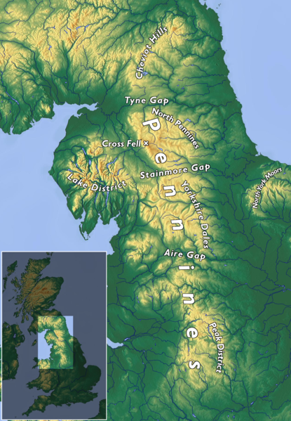
| 09:49, 20 June 2020 |  | 1,250 × 1,803 (3.17 MB) | Kreuzschnabel | {{Information |description ={{en|1=Topographic map of the Pennines}} {{de|1=Topographische Karte der Pennines}} |date =2020-06-20 |source ={{own}} |author =User:Kreuzschnabel, basemap from maps-for-free, CC0 licensed |permission ={{subst:User:Kreuzschnabel/Lizenz}} }} Category:Maps of the United Kingdom Category:Pennines (hills) Category:Images by Kreuzschnabel/Karten und Grafiken |
File usage
The following page uses this file:
Global file usage
The following other wikis use this file:
- Usage on ar.wikipedia.org
- Usage on de.wikipedia.org
- Usage on el.wikipedia.org
- Usage on es.wikipedia.org
- Usage on fr.wikipedia.org
- Usage on gl.wikipedia.org
- Usage on nl.wikipedia.org


