Jump to content

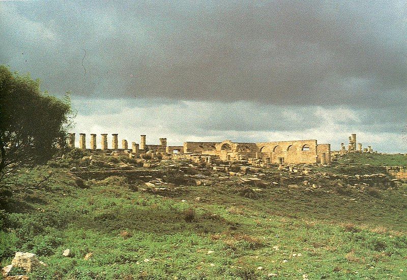
File:Tolmeitha ruins.jpg

Page contents not supported in other languages.
This is a file from the Wikimedia Commons
From Wikipedia, the free encyclopedia

Original file (1,537 × 1,056 pixels, file size: 1.39 MB, MIME type: image/jpeg)

Description
English: Ruins of Tolmeitha, Libya.
Date circa 1984
date QS:P,+1984-00-00T00:00:00Z/9,P1480,Q5727902
Source Al Lajna ash Sha'biya li Baladiya al Bayan al Awwal (Banghazi), Ad Daleel as Siyahi li Madina Benghazi, Starf fotolito pub., Rome, 1984.
Author Munsha'at al Akhdar lil Alwan, Benghazi.
Permission
(Reusing this file)
Public domain This work was first published on the Libya and is now in the public domain because its copyright protection has expired by virtue of the Copyright Protection Law, enacted 1968. The work meets one of the following criteria:
  • It is an anonymous work or pseudonymous work and 25 years have passed since the date of its publication
  • It is a work published after the death of the author and 50 have passed since the year of death of the author (or last-surviving author)
  • It is a photographic or cinematographic work that is not compositive (artistic in nature) and 5 years have elapsed since the end of the year of its publication
  • It is a work created by a legal public or private entity and 30 years have passed since the year the work was created
  • It is another type of work and than 25 years have elapsed since the the year of death of the author (or last-surviving author) and fifty years have elapsed since the year of publication.
  • It is one of "official documents such as texts of laws, decrees, regulations, international agreements, legal judgements and various official documents"

You must also include a United States public domain tag to indicate why this work is in the public domain in the United States.
Camera location32° 49′ 08.51″ N, 21° 51′ 29.99″ E Kartographer map based on OpenStreetMap.View this and other nearby images on: OpenStreetMapinfo
Object location32° 49′ 07.46″ N, 21° 51′ 24.73″ E Kartographer map based on OpenStreetMap.View this and other nearby images on: OpenStreetMapinfo

Captions

Add a one-line explanation of what this file represents

Items portrayed in this file

depicts

32°49'8.51"N, 21°51'29.99"E

32°49'7.46"N, 21°51'24.73"E

File history

Click on a date/time to view the file as it appeared at that time.

Date/TimeThumbnailDimensionsUserComment
current12:48, 31 July 2011Thumbnail for version as of 12:48, 31 July 20111,537 × 1,056 (1.39 MB)Maher27777{{Information |Description ={{en|1=Ruins of Tolmeitha, Libya.}} |Source =Al Lajna ash Sha'biya li Baladiya al Bayan al Awwal (Banghazi), Ad Daleel as Siyahi li Madina Benghazi, Starf fotolito pub., Rome, 1984. |Author =Munsha'at al Akhd

The following page uses this file:

Global file usage

The following other wikis use this file:

Metadata