Jump to content

File:Todoko-Rano.jpg

Page contents not supported in other languages.
This is a file from the Wikimedia Commons
From Wikipedia, the free encyclopedia

Todoko-Rano.jpg (320 × 222 pixels, file size: 19 KB, MIME type: image/jpeg)

Summary

Description
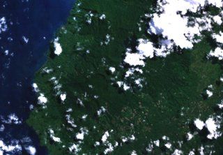
Русский: Западная часть острова Хальмахера, Индонезия. Район вулкана Тодоко-Рану.
English: The twin caldera complex of Todoko-Ranu appears in this NASA Landsat image of western Halmahera Island (with north to the top).
Bahasa Indonesia: Kompleks kaldera kembar Todoko-Ranu muncul dalam citra Landsat NASA di pulau Halmahera barat ini (dengan utara ke atas).
Date Unknown date
Source http://volcano.si.edu/volcano.cfm?vn=268050
Author NASA
Camera location1° 15′ 00″ N, 127° 28′ 12″ E Kartographer map based on OpenStreetMap.View this and other nearby images on: OpenStreetMapinfo

Licensing

Public domain This file is in the public domain in the United States because it was solely created by NASA. NASA copyright policy states that "NASA material is not protected by copyright unless noted". (See Template:PD-USGov, NASA copyright policy page or JPL Image Use Policy.)
Warnings:

Captions

Add a one-line explanation of what this file represents

Items portrayed in this file

depicts

1°15'0"N, 127°28'12"E

image/jpeg

458f4aa9d64df5cc12d61491d3a8a9cfb61f14e9

19,360 byte

222 pixel

320 pixel

File history

Click on a date/time to view the file as it appeared at that time.

Date/TimeThumbnailDimensionsUserComment
current08:13, 29 July 2017Thumbnail for version as of 08:13, 29 July 2017320 × 222 (19 KB)TefranoUser created page with UploadWizard

The following page uses this file:

Global file usage

The following other wikis use this file: