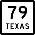
File:Texas 79.svg
Appearance

Size of this PNG preview of this SVG file: 384 × 384 pixels. Other resolutions: 240 × 240 pixels | 480 × 480 pixels | 768 × 768 pixels | 1,024 × 1,024 pixels | 2,048 × 2,048 pixels.
Original file (SVG file, nominally 384 × 384 pixels, file size: 8 KB)
File history
Click on a date/time to view the file as it appeared at that time.
| Date/Time | Thumbnail | Dimensions | User | Comment | |
|---|---|---|---|---|---|
| current | 13:20, 29 April 2006 |  | 384 × 384 (8 KB) | SPUI~commonswiki | {{spuiother}} {{Texas State Highway}} Category:Texas State Highway shields |
File usage
The following 29 pages use this file:
- Archer County, Texas
- Clay County, Texas
- Del Rio, Texas
- Farm to Market Road 171
- Farm to Market Road 1954
- List of Farm to Market Roads in Texas (1700–1799)
- List of Farm to Market Roads in Texas (2300–2399)
- List of highways numbered 79
- List of state highways in Texas
- Oklahoma State Highway 79
- Texas State Highway 114
- Texas State Highway 148
- Texas State Highway 25
- Texas State Highway 251
- Texas State Highway 79
- Texas State Highway Loop 473
- Throckmorton County, Texas
- U.S. Route 183 in Texas
- U.S. Route 281 in Texas
- U.S. Route 283 in Texas
- U.S. Route 287 in Texas
- U.S. Route 380
- U.S. Route 79
- U.S. Route 79 in Texas
- U.S. Route 80 in Texas
- Wichita County, Texas
- Young County, Texas
- User:Kinu/Sandbox2
- Wikipedia:WikiProject U.S. Roads/Redirects/Texas
Global file usage
The following other wikis use this file:
- Usage on el.wikipedia.org
- Usage on es.wikipedia.org
- Usage on fr.wikipedia.org
- Usage on id.wikipedia.org
- Usage on it.wikipedia.org
- Usage on ja.wikipedia.org
- Usage on pl.wikipedia.org
- Usage on ru.wikipedia.org
- Usage on zh-min-nan.wikipedia.org

