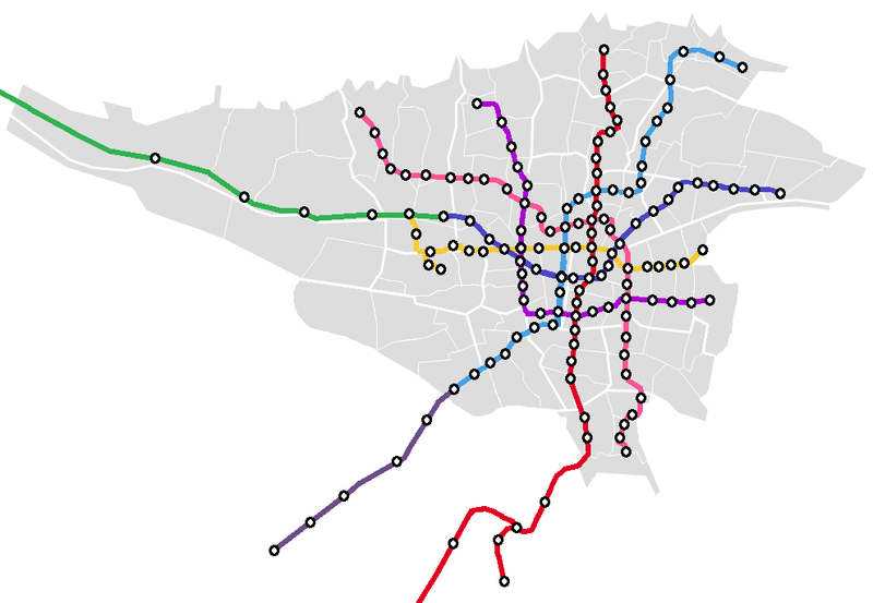
File:Tehran Metro map-Planned-geo.png
Appearance

Size of this preview: 800 × 553 pixels. Other resolutions: 320 × 221 pixels | 640 × 442 pixels | 990 × 684 pixels.
Original file (990 × 684 pixels, file size: 67 KB, MIME type: image/png)
File history
Click on a date/time to view the file as it appeared at that time.
| Date/Time | Thumbnail | Dimensions | User | Comment | |
|---|---|---|---|---|---|
| current | 00:59, 14 March 2021 |  | 990 × 684 (67 KB) | BasilLeaf | size fix |
| 19:34, 5 March 2021 |  | 1,450 × 684 (73 KB) | BasilLeaf | Islamshahr Line under construction, added to Tehran's masterplan | |
| 17:30, 29 September 2019 |  | 990 × 684 (65 KB) | BasilLeaf | Reverted to version as of 02:16, 16 September 2019 (UTC) | |
| 02:33, 29 September 2019 |  | 990 × 684 (60 KB) | BasilLeaf | line 6 extension | |
| 02:16, 16 September 2019 |  | 990 × 684 (65 KB) | BasilLeaf | fix | |
| 00:16, 16 September 2019 |  | 990 × 684 (65 KB) | BasilLeaf | fix | |
| 19:41, 13 September 2019 |  | 990 × 684 (62 KB) | BasilLeaf | fixes | |
| 07:06, 13 September 2019 |  | 991 × 570 (65 KB) | BasilLeaf | update | |
| 21:58, 26 September 2015 |  | 991 × 570 (63 KB) | BasilLeaf | User created page with UploadWizard |
File usage
The following page uses this file:
Global file usage
The following other wikis use this file:
- Usage on cs.wikipedia.org
- Usage on mr.wikipedia.org
- Usage on pl.wikipedia.org
- Usage on pnb.wikipedia.org
- Usage on ur.wikipedia.org
