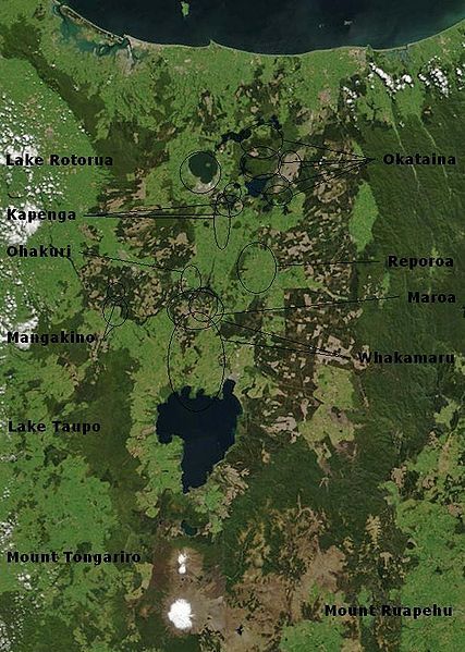
File:Taupo.Volcanic.Zone.North.Island.NZ.JPG
Appearance

Size of this preview: 427 × 599 pixels. Other resolutions: 171 × 240 pixels | 616 × 864 pixels.
Original file (616 × 864 pixels, file size: 104 KB, MIME type: image/jpeg)
File history
Click on a date/time to view the file as it appeared at that time.
| Date/Time | Thumbnail | Dimensions | User | Comment | |
|---|---|---|---|---|---|
| current | 02:17, 20 February 2010 |  | 616 × 864 (104 KB) | Chris.urs-o | One label was missing. |
| 01:49, 20 February 2010 |  | 616 × 864 (103 KB) | Chris.urs-o | Fixed label | |
| 10:42, 19 February 2010 |  | 616 × 864 (105 KB) | Chris.urs-o | Improved caldera locations | |
| 11:20, 18 February 2010 |  | 616 × 864 (103 KB) | Chris.urs-o | {{Information |Description=Bay of Plenty, North Island, New Zealand, from the Bay of Plenty coast to Mounts Tongariro, Ngauruhoe, and Ruapehu (at bottom of picture). Also shows Lake Taupo and the Rotorua Lakes. This scene was acquired by the Moderate Reso |
File usage
The following 3 pages use this file:
Global file usage
The following other wikis use this file:
- Usage on ar.wikipedia.org
- Usage on de.wikipedia.org
- Usage on en.wikiversity.org
- Usage on es.wikipedia.org
- Usage on fi.wikipedia.org
- Usage on id.wikipedia.org
- Usage on it.wikipedia.org
- Usage on mk.wikipedia.org
- Usage on ru.wikipedia.org
- Usage on simple.wikipedia.org
- Usage on sl.wikipedia.org
- Usage on uk.wikipedia.org


