File:TaiTamMapWithWord.png
Appearance

Size of this preview: 374 × 599 pixels. Other resolutions: 150 × 240 pixels | 299 × 480 pixels | 479 × 768 pixels | 639 × 1,024 pixels | 1,528 × 2,448 pixels.
Original file (1,528 × 2,448 pixels, file size: 980 KB, MIME type: image/png)
File history
Click on a date/time to view the file as it appeared at that time.
| Date/Time | Thumbnail | Dimensions | User | Comment | |
|---|---|---|---|---|---|
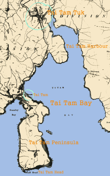
| current | 17:57, 30 June 2006 |  | 1,528 × 2,448 (980 KB) | HenryLi | Illustrative map of Tai Tam. (png version) (Adapted from The Ordnance Map of Hong Kong 1845 by Lieut. Collinson R. E. and John Francis Davis) Created by en:User:HenryLi |
File usage
The following 2 pages use this file:
