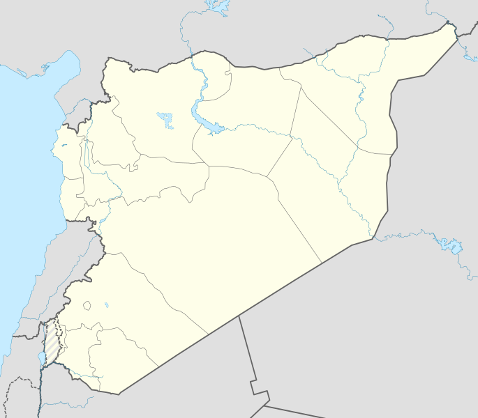
File:Syria location map3.svg
Appearance

Size of this PNG preview of this SVG file: 685 × 600 pixels. Other resolutions: 274 × 240 pixels | 548 × 480 pixels | 878 × 768 pixels | 1,170 × 1,024 pixels | 2,340 × 2,048 pixels | 922 × 807 pixels.
Original file (SVG file, nominally 922 × 807 pixels, file size: 288 KB)
File history
Click on a date/time to view the file as it appeared at that time.
| Date/Time | Thumbnail | Dimensions | User | Comment | |
|---|---|---|---|---|---|
| current | 14:07, 18 November 2022 |  | 922 × 807 (288 KB) | GrandEscogriffe | more correct N/S stretching |
| 15:55, 19 February 2016 |  | 922 × 762 (280 KB) | Deuar | Fixing bug (bogus grey line). Thank you to Kordestani for pointing it out. | |
| 21:09, 18 February 2016 |  | 922 × 762 (288 KB) | Deuar | nope, there was still a small issue with a lake | |
| 21:06, 18 February 2016 |  | 922 × 762 (280 KB) | Deuar | edits: Eastern Syria details of borders, rivers, etc. That's the last of it for this series of edits I hope. | |
| 18:23, 12 February 2016 |  | 922 × 762 (232 KB) | Deuar | minor fix - there was an accidental shift of lakes introduced | |
| 01:13, 8 February 2016 |  | 922 × 762 (224 KB) | Deuar | rectifying details in southern Syria and Golan | |
| 16:35, 30 January 2016 |  | 922 × 762 (199 KB) | Deuar | more rectyfying details - north of Damascus and east of Aleppo. Marked Lake Jabbul and Otaybah as intermittent. Lake Otaybah is smaller, too. | |
| 14:27, 28 January 2016 |  | 922 × 762 (197 KB) | Deuar | Brought back hashed Golan as per consensus (sorry for missing that), combined with the more precise lines of the version of 15:10, 27 January 2016. Also: saved as plain SVG instead of Inkscape SVG. | |
| 20:54, 27 January 2016 |  | 922 × 762 (166 KB) | Greyshark09 | Reverted to version as of 04:09, 18 June 2015 (UTC) | |
| 15:10, 27 January 2016 |  | 922 × 762 (200 KB) | Deuar | Correcting details: Hama region and al-Ghab plain |
File usage
The following 20 pages use this file:
- February 2013 Damascus bombings
- Geography of Syria
- Syria and weapons of mass destruction
- Talk:Control of cities during the Syrian civil war/Archive 59
- Talk:Syrian civil war/Archive 36
- Talk:Syrian civil war/Israel
- User:André437
- User:Bigles
- User:BlookyNapsta/sandbox
- User:Chickstarr404/Gather lists/13386 – "A Travelers Alphabet" by Stephen Runciman
- User:Lothar von Richthofen/Template:ISIS in Syria
- Wikipedia:Graphics Lab/Map workshop/Archive/Feb 2014
- File talk:Syria location map3.svg
- Template:Syrian Civil War detailed map
- Template:Syrian Civil War detailed map/sandbox
- Template:Syrian Civil War overview map
- Module:Syrian Civil War detailed map/doc
- Module:Syrian Civil War detailed map/sandbox/doc
- Module:Syrian Civil War overview map/doc
- Module talk:Location map/data/Syria
Global file usage
The following other wikis use this file:
- Usage on ace.wikipedia.org
- Usage on af.wikipedia.org
- Usage on am.wikipedia.org
- Usage on ar.wikipedia.org
- بوابة:سوريا
- قالب:خريطة مواقع سوريا
- قاعدة تفتناز الجوية العسكرية
- بوابة:سوريا/مواقع سياحية/أرشيف
- بوابة:سوريا/مواقع سياحية/1
- بوابة:سوريا/مواقع سياحية/8
- بوابة:سوريا/مواقع سياحية/26
- بوابة:سوريا/مواقع سياحية/21
- بوابة:سوريا/مواقع سياحية/18
- بوابة:سوريا/مواقع سياحية
- ابن قاضي الجبل
- البو سرايا
- تفجيرات فبراير 2013 في دمشق
- Usage on arz.wikipedia.org
- Usage on av.wikipedia.org
- Usage on azb.wikipedia.org
- Usage on az.wikipedia.org
- Usage on ba.wikipedia.org
- Usage on be-tarask.wikipedia.org
- Usage on be.wikipedia.org
View more global usage of this file.


