Jump to content

File:Stora Sjöfallet.jpg

Page contents not supported in other languages.
This is a file from the Wikimedia Commons
From Wikipedia, the free encyclopedia

Stora_Sjöfallet.jpg (790 × 512 pixels, file size: 70 KB, MIME type: image/jpeg)

Summary

Stora Sjöfallet (Stour Muorkkegårttje)   (Wikidata search (Cirrus search) Wikidata query (SPARQL)  Create new Wikidata item based on this file)
Photographer
Berit Wallenberg  (1902–1995)  wikidata:Q4990132
 
Berit Wallenberg
Alternative names
Anna Berit Wallenberg
Description Swedish archaeologist, art historian and photographer
Date of birth/death 19 February 1902 Edit this at Wikidata 4 September 1995 Edit this at Wikidata
Location of birth/death Skeppsholm church parish Edit this at Wikidata Lovö church parish Edit this at Wikidata
Authority file
creator QS:P170,Q4990132
Title
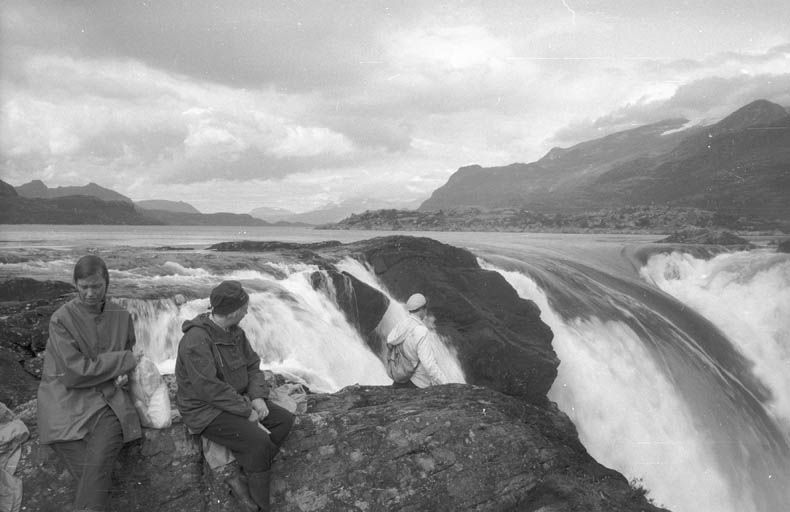
Stora Sjöfallet (Stour Muorkkegårttje)
Description
Svenska: Människor vid Stora sjöfallet
Depicted place County (län): Norrbotten, Municipality (kommun): Gällivare, Province (landskap): Lappland, Parish (socken): Gällivare
Date between 1 August 1961 and 31 August 1961
date QS:P571,+1961-08-00T00:00:00Z/10,P1319,+1961-08-01T00:00:00Z/11,P1326,+1961-08-31T00:00:00Z/11
institution QS:P195,Q631844
Accession number
Source Kulturmiljöbild, Riksantikvarieämbetet
Permission
(Reusing this file)
Public domain
This Swedish photograph is in the public domain in Sweden because one of the following applies:
  • The photograph does not reach the Swedish threshold of originality (common for snapshots and journalistic photos) and was created before 1 January 1975 (SFS 1960:729, § 49a).
  • The photograph was published anonymously before 1 January 1955 and the author did not reveal their identity during the following 70 years (SFS 1960:729, § 44).

For photos in the first category created before 1969, also {{PD-1996}} usually applies. For photos in the second category published before 1930, also {{PD-US-expired}} usually applies.

If the photographer died before 1955, {{PD-old-70}} should be used instead of this tag. If the author died before 1926, also {{PD-1996}} usually applies.

You must also include a United States public domain tag to indicate why this work is in the public domain in the United States.
Object location67° 45′ 16.08″ N, 19° 15′ 07.26″ E Kartographer map based on OpenStreetMap.View this and other nearby images on: OpenStreetMapinfo

Captions

Add a one-line explanation of what this file represents

Items portrayed in this file

depicts

67°45'16.078"N, 19°15'7.261"E

File history

Click on a date/time to view the file as it appeared at that time.

Date/TimeThumbnailDimensionsUserComment
current09:28, 12 August 2012Thumbnail for version as of 09:28, 12 August 2012790 × 512 (70 KB)Norrlanning96

The following page uses this file:

Global file usage

The following other wikis use this file:

Metadata