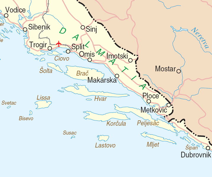
File:Southern Croatian Adriatic.png
Appearance

Size of this preview: 718 × 600 pixels. Other resolutions: 287 × 240 pixels | 575 × 480 pixels | 920 × 768 pixels | 1,049 × 876 pixels.
Original file (1,049 × 876 pixels, file size: 198 KB, MIME type: image/png)
File history
Click on a date/time to view the file as it appeared at that time.
| Date/Time | Thumbnail | Dimensions | User | Comment | |
|---|---|---|---|---|---|
| current | 11:15, 27 January 2020 |  | 1,049 × 876 (198 KB) | MacMoreno | Corretto isola di Vis con nome italiano Lissa |
| 16:59, 23 March 2007 |  | 1,049 × 876 (189 KB) | Minestrone | {{Information| |Description=Map of the Southern Croatian Adriatic Sea |Source=http://www.un.org/Depts/Cartographic/map/profile/croatia.pdf |Date=June, 2004 |Author=Department of Peacekeeping Operations Cartographic Section |Permission={{UN map}} }} |
File usage
The following page uses this file:
Global file usage
The following other wikis use this file:
- Usage on ar.wikipedia.org
- Usage on br.wikipedia.org
- Usage on cs.wikipedia.org
- Usage on de.wikipedia.org
- Usage on el.wikipedia.org
- Usage on fi.wikipedia.org
- Usage on fr.wikipedia.org
- Usage on hu.wikipedia.org
- Usage on is.wikipedia.org
- Usage on it.wikipedia.org
- Usage on pl.wikipedia.org
- Usage on pl.wiktionary.org
- Usage on sk.wikipedia.org
- Usage on sr.wikipedia.org
- Usage on uk.wikipedia.org
- Usage on vi.wikipedia.org

