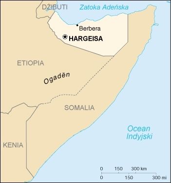
File:Somaliland CIA map PL.jpg
Appearance
Somaliland_CIA_map_PL.jpg (351 × 377 pixels, file size: 41 KB, MIME type: image/jpeg)
File history
Click on a date/time to view the file as it appeared at that time.
| Date/Time | Thumbnail | Dimensions | User | Comment | |
|---|---|---|---|---|---|
| current | 10:04, 4 November 2023 |  | 351 × 377 (41 KB) | Siirski | Reverted to version as of 18:27, 20 June 2020 (UTC) |
| 18:56, 1 October 2023 |  | 351 × 377 (25 KB) | Caawiyahaderon | https://www.thehindu.com/news/international/pro-somalia-militia-takes-key-army-base-in-breakaway-region/article67238670.ece | |
| 18:27, 20 June 2020 |  | 351 × 377 (41 KB) | Kzl55 | Reverted to version as of 18:15, 5 March 2010 (UTC) File shows CIA map of claimed Somaliland borders. Restored long standing stable version. | |
| 16:33, 20 June 2020 |  | 351 × 377 (26 KB) | Meelpringthusss | see ongoing discussion at File_talk:Somalia_map_states_regions_districts.png#There_is_nuance_with_regards_to_control | |
| 09:16, 20 June 2020 |  | 351 × 377 (41 KB) | Bboyfbg | Reverted to version as of 18:15, 5 March 2010 (UTC) | |
| 19:52, 17 June 2020 |  | 351 × 377 (26 KB) | Meelpringthusss | added disputed area | |
| 18:15, 5 March 2010 |  | 351 × 377 (41 KB) | Masur | {{Information |Description={{pl|Mapka Somalilandu}} |Source=CIA World Factbook - after modifications transferred from Polish Wikipedia. |Date= |Author=Central Intelligence Agency |Permission={{PD-USGov-CIA-WF}} |other_versions= }} [[Category:Maps of Somal |
File usage
The following page uses this file:
Global file usage
The following other wikis use this file:
- Usage on no.wikipedia.org
- Usage on pl.wikipedia.org
- Usage on pl.wiktionary.org
- Usage on sd.wikipedia.org


