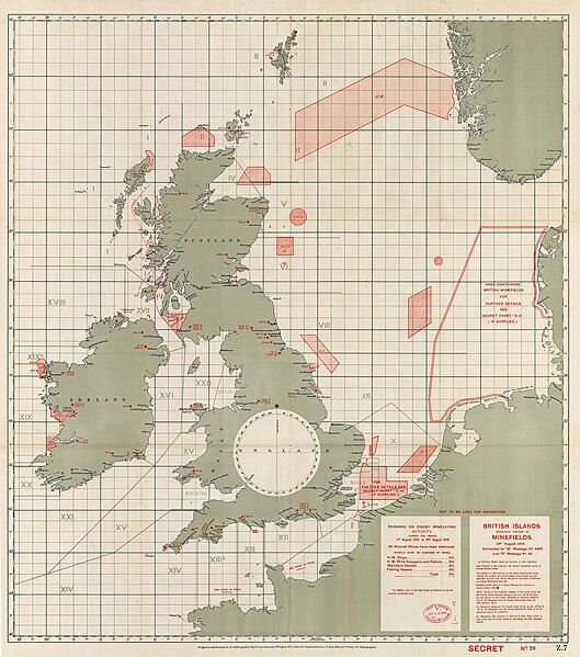
File:SeaMinefieldsWWI 1918.jpg
Appearance

Size of this preview: 529 × 599 pixels. Other resolutions: 212 × 240 pixels | 424 × 480 pixels | 678 × 768 pixels | 904 × 1,024 pixels | 2,000 × 2,265 pixels.
Original file (2,000 × 2,265 pixels, file size: 1.02 MB, MIME type: image/jpeg)
File history
Click on a date/time to view the file as it appeared at that time.
| Date/Time | Thumbnail | Dimensions | User | Comment | |
|---|---|---|---|---|---|
| current | 00:54, 19 May 2024 |  | 2,000 × 2,265 (1.02 MB) | Fangz | Uploaded a work by Hydrographic Department of the Admiralty, under superintendence of Rear-Admiral J.F. Parry from https://blogs.loc.gov/maps/2017/01/world-war-i-understanding-the-war-at-sea-through-maps/ with UploadWizard |
File usage
The following page uses this file:
Global file usage
The following other wikis use this file:
- Usage on ru.wikipedia.org

