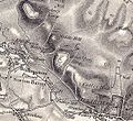
File:Scratchbury old map.JPG
Appearance
Scratchbury_old_map.JPG (591 × 544 pixels, file size: 125 KB, MIME type: image/jpeg)
File history
Click on a date/time to view the file as it appeared at that time.
| Date/Time | Thumbnail | Dimensions | User | Comment | |
|---|---|---|---|---|---|
| current | 22:53, 8 March 2011 |  | 591 × 544 (125 KB) | Pahazzard | {{Information |Description ={{en|1=an old OS map of scratchbury camp and surrounding area}} |Source =Ordnance Survey First Series, Sheet 14 |Author =HMO Ordnance Survey |Date =1817 |Permission = |other_versions = }} [[Ca |
File usage
The following page uses this file:
