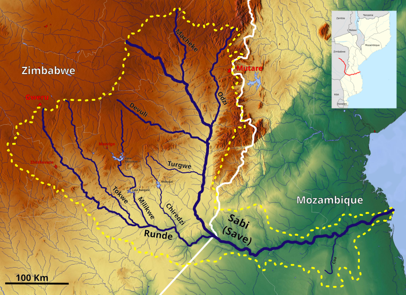
File:Save Basin OSM.svg
Appearance

Size of this PNG preview of this SVG file: 800 × 582 pixels. Other resolutions: 320 × 233 pixels | 640 × 466 pixels | 1,024 × 745 pixels | 1,280 × 931 pixels | 2,560 × 1,862 pixels | 1,559 × 1,134 pixels.
Original file (SVG file, nominally 1,559 × 1,134 pixels, file size: 7.07 MB)
File history
Click on a date/time to view the file as it appeared at that time.
| Date/Time | Thumbnail | Dimensions | User | Comment | |
|---|---|---|---|---|---|
| current | 15:11, 29 May 2022 |  | 1,559 × 1,134 (7.07 MB) | Peter in s | Kontrast, Lokation,... |
| 10:12, 26 September 2019 |  | 1,559 × 1,134 (7.02 MB) | Peter in s | {{Information |description ={{en|1=The Save Basin OSM}} |date =2019-09-26 |source =https://maps-for-free.com/ |author =Hans Braxmeier & Peter in s }} {{cc-by-sa-2.0}} Category:Maps of rivers of Zimbabwe Category:Maps of rivers of Mozambique Category:Drainage basin maps of Africa Category:Savi Basin |
File usage
The following 6 pages use this file:
Global file usage
The following other wikis use this file:
- Usage on af.wikipedia.org
- Usage on de.wikipedia.org
- Usage on es.wikipedia.org
- Usage on fi.wikipedia.org
- Usage on fr.wikipedia.org
- Usage on ha.wikipedia.org
- Usage on it.wikipedia.org
- Usage on pt.wikipedia.org
- Usage on sn.wikipedia.org
- Usage on sr.wikipedia.org
- Usage on www.wikidata.org
