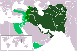
File:Sassanid empire map.png
Appearance
Sassanid_empire_map.png (250 × 165 pixels, file size: 6 KB, MIME type: image/png)
File history
Click on a date/time to view the file as it appeared at that time.
| Date/Time | Thumbnail | Dimensions | User | Comment | |
|---|---|---|---|---|---|
| current | 15:26, 19 January 2012 |  | 250 × 165 (6 KB) | Cplakidas | Reverted to version as of 18:54, 13 January 2011 per explanation on map borders (see talk) |
| 11:00, 14 January 2012 |  | 250 × 165 (6 KB) | Prince of Nothing05 | Reverted to version as of 08:10, 26 June 2007 | |
| 18:54, 13 January 2011 |  | 250 × 165 (6 KB) | Cplakidas | more realistic borders & corrections as regards maximum extent in the 7th century, per http://ecai.org/sasanianweb/sasanianmapmenu.html | |
| 08:10, 26 June 2007 |  | 250 × 165 (6 KB) | Ticketautomat | This picture is originally from english Wikipedia. The creator of this work released it into the public domain, please watch the page at english WP: en:Image:Sassanid empire map.PNG |
File usage
The following 4 pages use this file:
Global file usage
The following other wikis use this file:
- Usage on af.wikipedia.org
- Usage on ast.wiktionary.org
- Usage on az.wikipedia.org
- Usage on bg.wikipedia.org
- Usage on bn.wikipedia.org
- Usage on ca.wikipedia.org
- Usage on cs.wikipedia.org
- Usage on el.wikipedia.org
- Usage on eo.wikipedia.org
- Usage on es.wikipedia.org
- Usage on et.wikipedia.org
- Usage on eu.wikipedia.org
View more global usage of this file.

