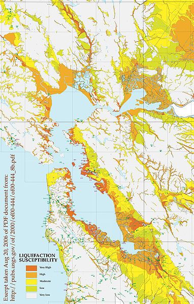
File:SFBALiqufactionMap.jpg
Appearance

Size of this preview: 382 × 599 pixels. Other resolutions: 153 × 240 pixels | 306 × 480 pixels | 1,019 × 1,597 pixels.
Original file (1,019 × 1,597 pixels, file size: 884 KB, MIME type: image/jpeg)
File history
Click on a date/time to view the file as it appeared at that time.
| Date/Time | Thumbnail | Dimensions | User | Comment | |
|---|---|---|---|---|---|
| current | 23:52, 15 January 2007 |  | 1,019 × 1,597 (884 KB) | MECU | {{Information |Description=Excerpt from USGS site, PDF Map http://pubs.usgs.gov/of/2000/of00-444/of00-444_8b.pdf Exerpt by en:User:Leonard G. |Source=Originally from [http://en.wikipedia.org en.wikipedia]; description page is/was [http://en.wikipedi |
File usage
The following 2 pages use this file:
Global file usage
The following other wikis use this file:
- Usage on ca.wikipedia.org
- Usage on de.wikipedia.org
- Usage on es.wikipedia.org
- Usage on hu.wikipedia.org
- Usage on ig.wikipedia.org

