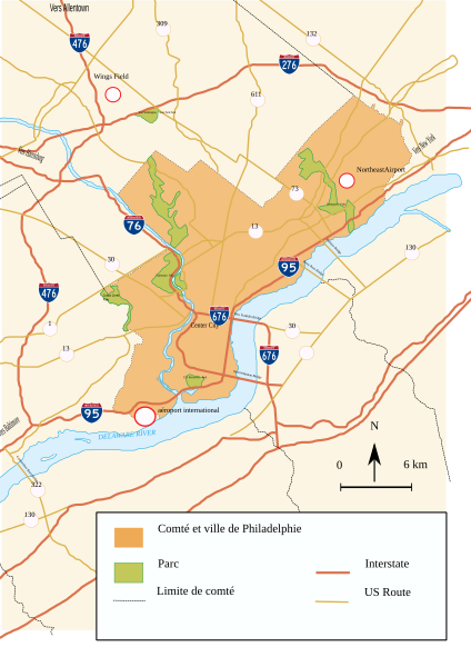
File:Routes Philadelphie.svg
Appearance

Size of this PNG preview of this SVG file: 424 × 600 pixels. Other resolutions: 170 × 240 pixels | 339 × 480 pixels | 543 × 768 pixels | 724 × 1,024 pixels | 1,448 × 2,048 pixels | 744 × 1,052 pixels.
Original file (SVG file, nominally 744 × 1,052 pixels, file size: 362 KB)
File history
Click on a date/time to view the file as it appeared at that time.
| Date/Time | Thumbnail | Dimensions | User | Comment | |
|---|---|---|---|---|---|
| current | 14:02, 10 March 2010 |  | 744 × 1,052 (362 KB) | AnonMoos | eliminating "flowtext" nonsense... |
| 11:03, 10 March 2010 |  | 744 × 1,052 (369 KB) | AnonMoos | removing external image references | |
| 15:11, 19 July 2007 |  | 744 × 1,052 (371 KB) | Urban~commonswiki | {{Information |Description=Map of Philadelphia Area + roads |Source=self-made |Date=19-07-2007 |Author= Urban }} Category:Philadelphia, Pennsylvania {{pd-self}} | |
| 14:43, 19 July 2007 |  | 744 × 1,052 (371 KB) | Urban~commonswiki | {{Information |Description=Map of Philadelphia Area + roads |Source=self-made |Date=19-07-2007 |Author= Urban }} Category:Philadelphia, Pennsylvania {{pd-self}} |
File usage
The following page uses this file:
