
File:Rosewood Massacre Map.PNG
Size of this preview: 659 × 599 pixels. Other resolutions: 264 × 240 pixels | 528 × 480 pixels | 742 × 675 pixels.
Original file (742 × 675 pixels, file size: 46 KB, MIME type: image/png)
| This is a file from the Wikimedia Commons. Information from its description page there is shown below. Commons is a freely licensed media file repository. You can help. |
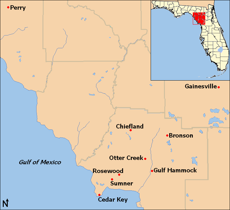
| Description | Map of locations mentioned in the Rosewood massacre article in northwestern Florida, United States. |
| Date | |
| Source | taken from US Census website [1] and modified by User:Ruhrfisch. Inset map is modified version of File:Map of Florida highlighting Gilchrist County.svg |
| Author | US Census, Ruhrfisch, inset is based on map by User:Dbenbenn |
| Permission (Reusing this file) |
US Census / US Government work is public domain, my modifications licensed under the GNU Free Documentation License |

|
Permission is granted to copy, distribute and/or modify this document under the terms of the GNU Free Documentation License, Version 1.2 or any later version published by the Free Software Foundation; with no Invariant Sections, no Front-Cover Texts, and no Back-Cover Texts. A copy of the license is included in the section entitled GNU Free Documentation License. |
| This file is licensed under the Creative Commons Attribution-Share Alike 3.0 Unported license. | ||
| ||
| This licensing tag was added to this file as part of the GFDL licensing update. |
File history
Click on a date/time to view the file as it appeared at that time.
| Date/Time | Thumbnail | Dimensions | User | Comment | |
|---|---|---|---|---|---|
| current | 14:12, 14 April 2009 | | 742 × 675 (46 KB) | Ruhrfisch | Add inset locator map of Florida, based on File:Map of Florida highlighting Gilchrist County.svg, all other information is the same |
| 05:59, 14 April 2009 |  | 742 × 675 (30 KB) | Ruhrfisch | {{Information| |Description= Map of locations mentioned in the Rosewood massacre article in northwestern Florida, United States. |Source= taken from US Census website [http://factfinder.census.gov/] and modified by [[User:Ruhrfisc |
File usage
The following 2 pages use this file:
Global file usage
The following other wikis use this file:
- Usage on ar.wikipedia.org
- Usage on ca.wikipedia.org
- Usage on es.wikipedia.org
- Usage on eu.wikipedia.org
- Usage on fr.wikipedia.org
- Usage on he.wikipedia.org
- Usage on ko.wikipedia.org
- Usage on pt.wikipedia.org
- Usage on www.wikidata.org