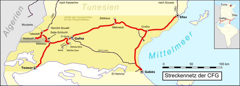
File:Reseau cfg tunisie.svg
Appearance

Size of this PNG preview of this SVG file: 800 × 286 pixels. Other resolutions: 320 × 115 pixels | 640 × 229 pixels | 1,024 × 367 pixels | 1,280 × 458 pixels | 2,560 × 916 pixels | 813 × 291 pixels.
Original file (SVG file, nominally 813 × 291 pixels, file size: 2.37 MB)
File history
Click on a date/time to view the file as it appeared at that time.
| Date/Time | Thumbnail | Dimensions | User | Comment | |
|---|---|---|---|---|---|
| current | 23:13, 21 April 2017 | 813 × 291 (2.37 MB) | Pechristener | frame issue fixed (attempt 2) | |
| 23:08, 21 April 2017 | 814 × 291 (2.37 MB) | Pechristener | issue with frame fixed | ||
| 23:05, 21 April 2017 | 814 × 291 (2.37 MB) | Pechristener | location map added | ||
| 00:22, 18 April 2017 | 814 × 291 (1.87 MB) | Pechristener | == {{int:filedesc}} == {{Information |Description={{fr|Réseau des chemins de fer de la {{f|Compagnie des phosphates et des chemins de fer de Gafsa}}}} |Source = Map was created using: *[http://www.openstreetmap.org/ Open Street Map] *{{f|Re... |
File usage
The following page uses this file:
Global file usage
The following other wikis use this file:
- Usage on de.wikipedia.org
- Usage on it.wikipedia.org
- Usage on www.wikidata.org


