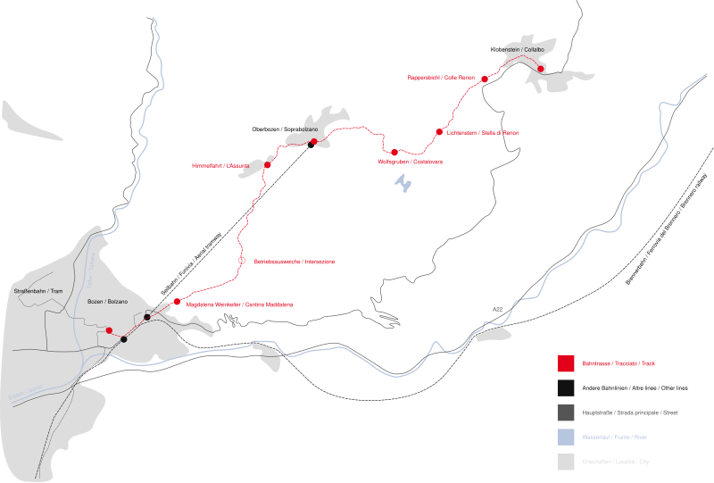
File:RenonRailroadMap.svg
Appearance

Size of this PNG preview of this SVG file: 800 × 540 pixels. Other resolutions: 320 × 216 pixels | 640 × 432 pixels | 1,024 × 691 pixels | 1,280 × 864 pixels | 2,560 × 1,728 pixels | 2,575 × 1,738 pixels.
Original file (SVG file, nominally 2,575 × 1,738 pixels, file size: 64 KB)
File history
Click on a date/time to view the file as it appeared at that time.
| Date/Time | Thumbnail | Dimensions | User | Comment | |
|---|---|---|---|---|---|
| current | 14:38, 6 January 2016 |  | 2,575 × 1,738 (64 KB) | Kopiersperre | cropped |
| 15:50, 21 January 2010 |  | 4,213 × 2,980 (77 KB) | Lucaf1 | Reverted to version as of 15:15, 2 January 2007 | |
| 15:50, 21 January 2010 |  | 821 × 613 (90 KB) | Lucaf1 | zoom | |
| 15:15, 2 January 2007 |  | 4,213 × 2,980 (77 KB) | Luigino | {{Information |Description=Map of the Renon Railroad / Karte der Rittnerbahn / Mappa della ferrovia del Renon |Source=own work |Date=02.01.2007 |Author=~~~ |Permission= |other_versions= }} |
File usage
The following page uses this file:
Global file usage
The following other wikis use this file:
- Usage on de.wikipedia.org
- Usage on hu.wikipedia.org
- Usage on id.wikipedia.org
- Usage on it.wikipedia.org
- Usage on www.wikidata.org
