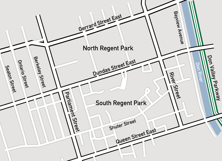
File:Regents Park Map.png
Appearance
Regents_Park_Map.png (720 × 520 pixels, file size: 133 KB, MIME type: image/png)
File history
Click on a date/time to view the file as it appeared at that time.
| Date/Time | Thumbnail | Dimensions | User | Comment | |
|---|---|---|---|---|---|
| current | 02:06, 23 July 2008 |  | 720 × 520 (133 KB) | Pacific Coast Highway | {{Information |Description= |Source= |Date= |Author= |Permission= |other_versions= }} |
| 21:50, 22 July 2008 |  | 720 × 520 (135 KB) | Pacific Coast Highway | {{Information |Description= |Source= |Date= |Author= |Permission= |other_versions= }} | |
| 21:45, 22 July 2008 |  | 720 × 520 (129 KB) | Pacific Coast Highway | {{Information |Description={{en|1=A map of Regent Park, Toronto, created with Adobe Illustrator CS3.}} |Source=Own work by uploader |Author=Pacific Coast Highway |Date= |
File usage
The following page uses this file:

