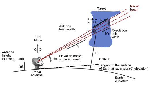
File:Radar-hauteur-en.svg
Appearance

Size of this PNG preview of this SVG file: 563 × 313 pixels. Other resolutions: 320 × 178 pixels | 640 × 356 pixels | 1,024 × 569 pixels | 1,280 × 712 pixels | 2,560 × 1,423 pixels.
Original file (SVG file, nominally 563 × 313 pixels, file size: 42 KB)
File history
Click on a date/time to view the file as it appeared at that time.
| Date/Time | Thumbnail | Dimensions | User | Comment | |
|---|---|---|---|---|---|
| current | 04:35, 21 December 2011 |  | 563 × 313 (42 KB) | Pierre cb | Added info |
| 16:45, 7 December 2011 |  | 563 × 313 (40 KB) | Pierre cb | Small correction | |
| 15:11, 7 December 2011 |  | 563 × 313 (40 KB) | Pierre cb | Add colors and info from translated Radar_hateur-fr.svg | |
| 15:30, 7 June 2008 |  | 563 × 313 (22 KB) | VIGNERON | {{Information |Description={{fr|1=Hauteur du faisceau radar (AGL). Calcul de la hauteur des échos reçus par un radar météorologique ainsi que le principe d'opération.}} |Source=travail personnel (own work) |Author=VIGNERON et [[User |
File usage
The following 2 pages use this file:
Global file usage
The following other wikis use this file:
- Usage on fr.wikipedia.org
- Usage on ja.wikipedia.org
- Usage on ru.wikipedia.org


