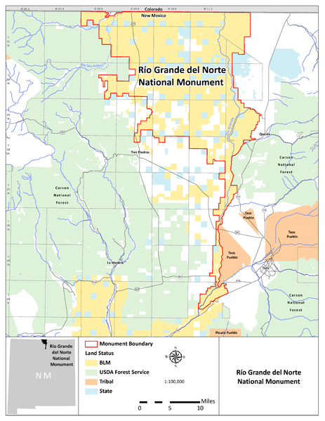
File:RGDNMap.png
Appearance

Size of this preview: 463 × 599 pixels. Other resolutions: 185 × 240 pixels | 371 × 480 pixels | 593 × 768 pixels | 791 × 1,024 pixels | 1,582 × 2,048 pixels | 3,400 × 4,400 pixels.
Original file (3,400 × 4,400 pixels, file size: 896 KB, MIME type: image/png)
File history
Click on a date/time to view the file as it appeared at that time.
| Date/Time | Thumbnail | Dimensions | User | Comment | |
|---|---|---|---|---|---|
| current | 13:41, 26 March 2013 |  | 3,400 × 4,400 (896 KB) | Acroterion | {{Information |Description ={{en|1=Map of Rio Grande del Norte National Monument, New Mexico, USA}} |Source =http://www.blm.gov/pgdata/etc/medialib/blm/nm/programs/recreation/rec_docs/rec_docs_taos.Par.94909.File.dat/RGDNMap.pdf |Author ... |
File usage
The following page uses this file:
Global file usage
The following other wikis use this file:
- Usage on de.wikipedia.org
- Usage on fr.wikipedia.org

