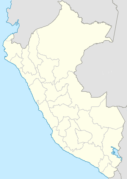
File:Perú · (departamentos).png
Appearance

Size of this preview: 427 × 599 pixels. Other resolutions: 171 × 240 pixels | 520 × 730 pixels.
Original file (520 × 730 pixels, file size: 23 KB, MIME type: image/png)
File history
Click on a date/time to view the file as it appeared at that time.
| Date/Time | Thumbnail | Dimensions | User | Comment | |
|---|---|---|---|---|---|
| current | 06:53, 15 July 2009 |  | 520 × 730 (23 KB) | Huhsunqu | colores |
| 18:48, 12 November 2006 |  | 520 × 730 (23 KB) | Huhsunqu | colores | |
| 06:27, 27 October 2006 |  | 520 × 730 (23 KB) | Huhsunqu | ||
| 18:19, 9 October 2006 |  | 520 × 730 (23 KB) | Huhsunqu | ||
| 16:19, 6 October 2006 |  | 520 × 730 (23 KB) | Huhsunqu | == Sumario== {{qu|Piruw departamentokuna saywitu.}} {{en|Map of the Peruvian departaments.}} {{es|Mapa de los departamentos del Perú.}} Category:Location maps of departaments of Peru Category:Map templates == Origen == {{Huhsunqu}} |
File usage
The following page uses this file:
Global file usage
The following other wikis use this file:
- Usage on eo.wikipedia.org
- Usage on fi.wikipedia.org
- Ica
- Lima
- Machu Picchu
- Arequipa
- Chachapoyas
- Cajamarca
- Huánuco
- Callao
- Pisco
- Iquitos
- Puno
- Trujillo
- Cusco
- Talara
- Piura
- Juliaca
- Tacna
- Tumbes
- Ayacucho
- Cerro de Pasco
- Chiclayo
- Pucallpa
- Puerto Maldonado
- Tarapoto
- Chan Chan
- Copa América 2004
- Huaraz
- Malline:Sijaintikartta Peru
- Abancay
- Moyobamba
- Huancavelica
- Huancayo
- Huacho
- Moquegua
- Chimbote
- Sullana
- Ollantaytambo
- Ilo (Peru)
- Chankillo
- Usage on fr.wikipedia.org
- Usage on gl.wikipedia.org
- Usage on no.wikipedia.org
- Usage on pl.wikipedia.org
- Usage on pt.wikipedia.org
- Usage on ro.wikipedia.org
- Usage on sv.wikipedia.org


