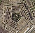
File:Pentagon-USGS-highres.jpg
Appearance

Size of this preview: 543 × 599 pixels. Other resolutions: 217 × 240 pixels | 435 × 480 pixels | 696 × 768 pixels | 927 × 1,024 pixels | 1,855 × 2,048 pixels | 3,202 × 3,535 pixels.
Original file (3,202 × 3,535 pixels, file size: 8.4 MB, MIME type: image/jpeg)
File history
Click on a date/time to view the file as it appeared at that time.
| Date/Time | Thumbnail | Dimensions | User | Comment | |
|---|---|---|---|---|---|
| current | 07:18, 30 November 2008 |  | 3,202 × 3,535 (8.4 MB) | MBisanz | {{Information |Description={{en|1=Aerial view of The Pentagon}} |Source=[http://terraserver-usa.com/usgsentry.aspx?T=4&S=11&Z=18&X=803&Y=10761&W=3&qs=North+Rotary+Rd%7cArlington%7cVA%7c&Addr=N+Rotary+Rd%2c+Fort+Myer%2c+VA+22211&ALon=-77 |
File usage
The following page uses this file:
Global file usage
The following other wikis use this file:
- Usage on ca.wikipedia.org
- Usage on ga.wikipedia.org
- Usage on hu.wikipedia.org
- Usage on vec.wikipedia.org
- Usage on www.wikidata.org


