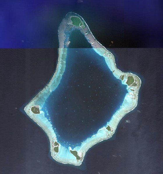
File:Palmerston Aerial.jpg
Appearance

Size of this preview: 560 × 600 pixels. Other resolutions: 224 × 240 pixels | 448 × 480 pixels | 678 × 726 pixels.
Original file (678 × 726 pixels, file size: 120 KB, MIME type: image/jpeg)
File history
Click on a date/time to view the file as it appeared at that time.
| Date/Time | Thumbnail | Dimensions | User | Comment | |
|---|---|---|---|---|---|
| current | 00:34, 28 April 2009 |  | 678 × 726 (120 KB) | Wildrosenz | Reverted to version as of 08:21, 24 June 2007 |
| 08:50, 13 February 2008 |  | 409 × 604 (26 KB) | Telim tor | better version | |
| 08:21, 24 June 2007 |  | 678 × 726 (120 KB) | Aotearoa | Satellite Image of Palmerston, Cook Islands. Category:Palmerston Category:Satellite pictures of the Cook Islands ==Licensing== {{PD-USGov-NASA}} |
File usage
The following page uses this file:
Global file usage
The following other wikis use this file:
- Usage on ca.wikipedia.org
- Usage on cs.wikipedia.org
- Usage on es.wikipedia.org
- Usage on fi.wikipedia.org
- Usage on id.wikipedia.org
- Usage on is.wikipedia.org
- Usage on it.wikipedia.org
- Usage on ka.wikipedia.org
- Usage on la.wikipedia.org
- Usage on lt.wikipedia.org
- Usage on mt.wikipedia.org
- Usage on no.wikipedia.org
- Usage on pl.wikipedia.org
- Usage on ru.wikipedia.org
- Usage on su.wikipedia.org
- Usage on uk.wikipedia.org


