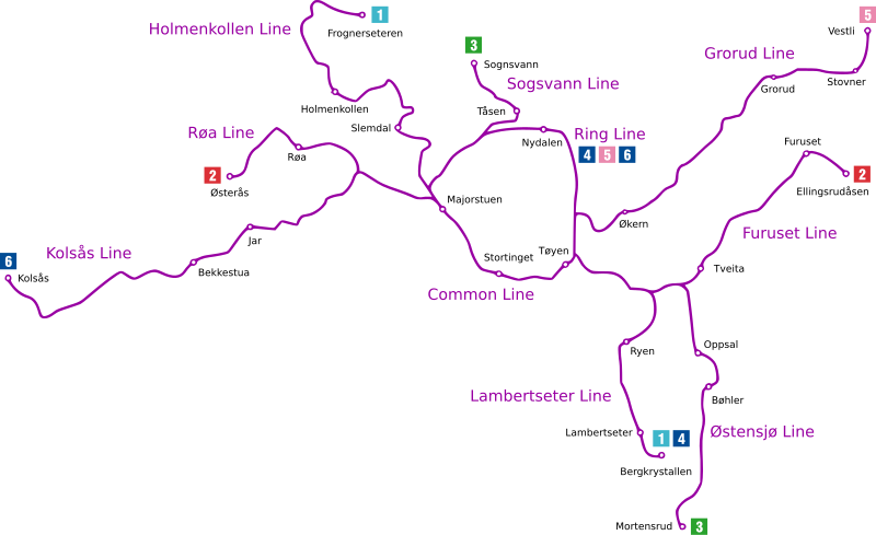
File:Oslo Metro map.svg
Appearance

Size of this PNG preview of this SVG file: 800 × 489 pixels. Other resolutions: 320 × 196 pixels | 640 × 391 pixels | 1,024 × 626 pixels | 1,280 × 782 pixels | 2,560 × 1,564 pixels | 1,586 × 969 pixels.
Original file (SVG file, nominally 1,586 × 969 pixels, file size: 69 KB)
File history
Click on a date/time to view the file as it appeared at that time.
| Date/Time | Thumbnail | Dimensions | User | Comment | |
|---|---|---|---|---|---|
| current | 23:10, 18 November 2009 |  | 1,586 × 969 (69 KB) | Arsenikk | Move "Ring Line" and 4/5/6 to make it clear they do not terminate at Nydalen |
| 11:10, 18 November 2009 |  | 1,586 × 969 (67 KB) | Tryphon | Trying to remove the black line. | |
| 00:39, 18 November 2009 |  | 1,586 × 969 (81 KB) | Arsenikk | {{Information |Description=Diagram of the Oslo Metro |Source=*File:Tbane_geogr.gif |Date=2009-11-18 00:36 (UTC) |Author=*File:Tbane_geogr.gif: Pneumaman *derivative work: ~~~ |Permission=see below |other_ve |
File usage
The following 2 pages use this file:
