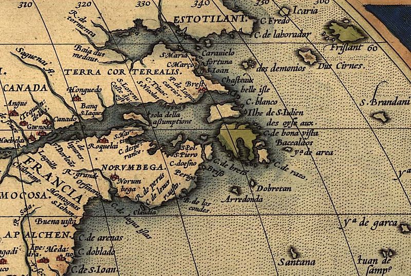
File:NorthEastAmericaOrtelius1570.jpg
Appearance

Size of this preview: 800 × 538 pixels. Other resolutions: 320 × 215 pixels | 640 × 431 pixels | 1,024 × 689 pixels | 1,497 × 1,007 pixels.
Original file (1,497 × 1,007 pixels, file size: 589 KB, MIME type: image/jpeg)
File history
Click on a date/time to view the file as it appeared at that time.
| Date/Time | Thumbnail | Dimensions | User | Comment | |
|---|---|---|---|---|---|
| current | 19:58, 5 June 2009 |  | 1,497 × 1,007 (589 KB) | Gabagool | {{Information |Description={{en|1=Northeastern part of Ortelius Americas map from 1570. (Map showing numerous more or less anachronisticly placed mythical names on locations which was regular for maps in that time. For instance: Norvmbega, Terra Cortereal |
File usage
The following 3 pages use this file:
Global file usage
The following other wikis use this file:
- Usage on ca.wikipedia.org
- Usage on de.wikipedia.org
- Usage on fr.wikipedia.org
- Usage on it.wikipedia.org
- Usage on oc.wikipedia.org
- Usage on pl.wikipedia.org
- Usage on pt.wikipedia.org
- Usage on tr.wikipedia.org
- Usage on uk.wikipedia.org
