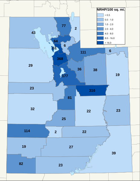
File:NRHP Utah Map.svg
Appearance

Size of this PNG preview of this SVG file: 463 × 599 pixels. Other resolutions: 185 × 240 pixels | 371 × 480 pixels | 593 × 768 pixels | 791 × 1,024 pixels | 1,582 × 2,048 pixels | 765 × 990 pixels.
Original file (SVG file, nominally 765 × 990 pixels, file size: 6.68 MB)
File history
Click on a date/time to view the file as it appeared at that time.
| Date/Time | Thumbnail | Dimensions | User | Comment | |
|---|---|---|---|---|---|
| current | 11:42, 12 April 2022 |  | 765 × 990 (6.68 MB) | 25or6to4 | Updated through March 2022 |
| 08:15, 24 March 2019 |  | 816 × 1,056 (1.78 MB) | 25or6to4 | Updated through March 1, 2019. | |
| 17:57, 3 April 2016 |  | 612 × 792 (1.11 MB) | 25or6to4 | Updated through January 1, 2016 | |
| 18:17, 15 September 2014 |  | 612 × 792 (1.12 MB) | 25or6to4 | Updated through September 2014 | |
| 07:40, 16 September 2012 |  | 792 × 612 (411 KB) | 25or6to4 | updated through August 2012 | |
| 22:18, 18 January 2010 |  | 612 × 792 (309 KB) | 25or6to4 | {{Information |Description={{en|1=Map of Utah NRHP/100 sq. mi., by county. As of 1/8/10}} |Source={{own}} |Author=25or6to4 |Date=01/18/10 |Permission= |other_versions= }} Category:Maps of Utah [[Category:National Register of Histor |
File usage
The following page uses this file:
Global file usage
The following other wikis use this file:
- Usage on pt.wikipedia.org
- Usage on ro.wikipedia.org

