File:NODInundationMay2011Scenario2.jpg
Appearance

Size of this preview: 800 × 522 pixels. Other resolutions: 320 × 209 pixels | 640 × 418 pixels | 1,024 × 668 pixels | 1,280 × 835 pixels | 2,560 × 1,671 pixels | 5,000 × 3,263 pixels.
Original file (5,000 × 3,263 pixels, file size: 2.55 MB, MIME type: image/jpeg)
File history
Click on a date/time to view the file as it appeared at that time.
| Date/Time | Thumbnail | Dimensions | User | Comment | |
|---|---|---|---|---|---|
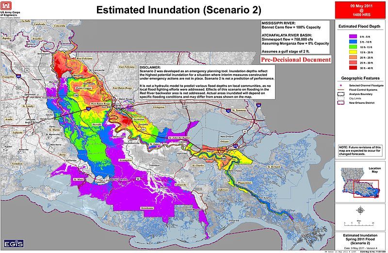
| current | 02:58, 12 May 2011 |  | 5,000 × 3,263 (2.55 MB) | Kkmurray | {{Information |Description ={{en|1=Inundation Map Scenario 2 depicting the anticipated impacts from non-operation of the Morganza Floodway with the Bonnet Carre’ Spillway operating at 100% capacity (http://www.mvn.usace.army.mil/bcarre/missriver.asp) |
File usage
The following 2 pages use this file:
Global file usage
The following other wikis use this file:
- Usage on de.wikipedia.org
- Usage on ko.wikipedia.org

