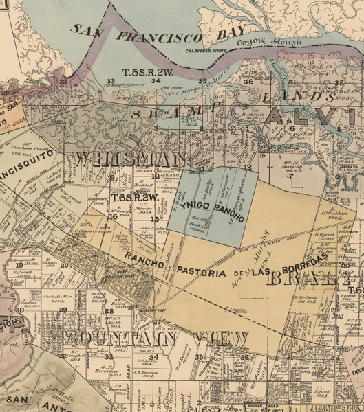
File:MountainView-1890.png
Appearance

Size of this preview: 529 × 600 pixels. Other resolutions: 212 × 240 pixels | 423 × 480 pixels | 677 × 768 pixels | 903 × 1,024 pixels | 1,806 × 2,048 pixels | 3,832 × 4,345 pixels.
Original file (3,832 × 4,345 pixels, file size: 25.5 MB, MIME type: image/png)
File history
Click on a date/time to view the file as it appeared at that time.
| Date/Time | Thumbnail | Dimensions | User | Comment | |
|---|---|---|---|---|---|
| current | 02:51, 16 November 2024 |  | 3,832 × 4,345 (25.5 MB) | Erp | Uploaded a work by Board of Supervisors, Santa Clara County, California Herrmann Bros. Britton & Rey. from Library of Congress, Official map of the County of Santa Clara, California : compiled from U.S. surveys, county records, and private surveys and the tax-list of 1889, by order of the Hon. Board of Supervisors. Published 1890 https://www.loc.gov/item/2012592102/ This is a subsection showing only what is to become Mountain View, CA and surrounding area with UploadWizard |
File usage
The following 3 pages use this file:
