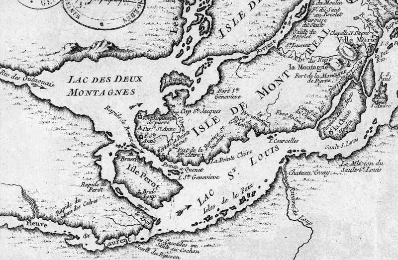
File:Montreal1764CedarsDetail.png
Appearance

Size of this preview: 800 × 523 pixels. Other resolutions: 320 × 209 pixels | 640 × 418 pixels | 1,067 × 697 pixels.
Original file (1,067 × 697 pixels, file size: 1.19 MB, MIME type: image/png)
File history
Click on a date/time to view the file as it appeared at that time.
| Date/Time | Thumbnail | Dimensions | User | Comment | |
|---|---|---|---|---|---|
| current | 22:57, 23 January 2009 |  | 1,067 × 697 (1.19 MB) | Magicpiano | {{Information |Description={{en|1=This is a detail of the original source map, cropped to depict the western part of the Isle of Montreal and immediately surrounding mainland as far as Les Cèdres. The map's caption reads "Montreal et ses Environs" (Mont |
File usage
The following 4 pages use this file:
Global file usage
The following other wikis use this file:
- Usage on ar.wikipedia.org
- Usage on es.wikipedia.org
- Usage on it.wikipedia.org
- Usage on ja.wikipedia.org
- Usage on nl.wikipedia.org
- Usage on www.wikidata.org
- Usage on zh.wikipedia.org
